You are here: Home > Network List > BK - Berkeley Digital Seismograph Network Stations List
> Station HUMO Hull Mountain, OR > Earthquake Result Viewer
HUMO Hull Mountain, OR - Earthquake Result Viewer
*The percent match for this event was below the threshold and hence no stack was calculated.
| Earthquake location: |
Solomon Islands |
| Earthquake latitude/longitude: |
-10.3/162.0 |
| Earthquake time(UTC): |
2011/07/20 (201) 22:04:59 GMT |
| Earthquake Depth: |
21 km |
| Earthquake Magnitude: |
5.9 MB, 5.6 MS, 6.0 MW, 6.0 MW |
| Earthquake Catalog/Contributor: |
WHDF/NEIC |
|
| Network: |
BK Berkeley Digital Seismograph Network |
| Station: |
HUMO Hull Mountain, OR |
| Lat/Lon: |
42.61 N/122.96 W |
| Elevation: |
555 m |
|
| Distance: |
86.1 deg |
| Az: |
45.631 deg |
| Baz: |
252.317 deg |
| Ray Param: |
$rayparam |
*The percent match for this event was below the threshold and hence was not used in the summary stack. |
|
| Radial Match: |
78.12462 % |
| Radial Bump: |
400 |
| Transverse Match: |
62.11918 % |
| Transverse Bump: |
400 |
| SOD ConfigId: |
401841 |
| Insert Time: |
2011-12-21 06:32:17.578 +0000 |
| GWidth: |
2.5 |
| Max Bumps: |
400 |
| Tol: |
0.001 |
|
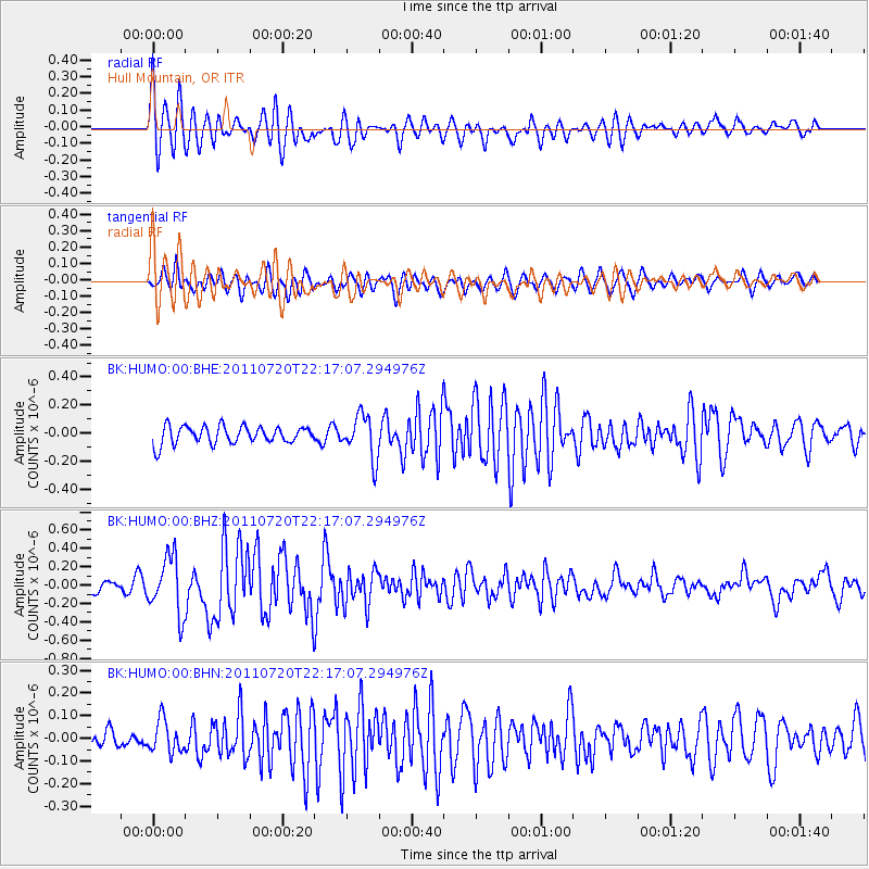
Signal To Noise
| Channel | StoN | STA | LTA |
| BK:HUMO:00:BHZ:20110720T22:17:07.294976Z | 4.7488303 | 3.122305E-7 | 6.574893E-8 |
| BK:HUMO:00:BHN:20110720T22:17:07.294976Z | 1.1434684 | 7.144019E-8 | 6.247675E-8 |
| BK:HUMO:00:BHE:20110720T22:17:07.294976Z | 2.4724195 | 1.533168E-7 | 6.201084E-8 |
| Arrivals |
| Ps | |
| PpPs | |
| PsPs/PpSs | |


