You are here: Home > Network List > CI - Caltech Regional Seismic Network Stations List
> Station MPP McPhearson Peak > Earthquake Result Viewer
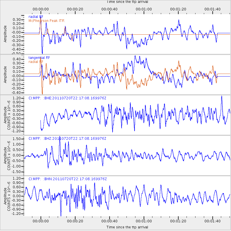
MPP McPhearson Peak - Earthquake Result Viewer
*The percent match for this event was below the threshold and hence no stack was calculated.
| Earthquake location: |
Solomon Islands |
| Earthquake latitude/longitude: |
-10.3/162.0 |
| Earthquake time(UTC): |
2011/07/20 (201) 22:04:59 GMT |
| Earthquake Depth: |
21 km |
| Earthquake Magnitude: |
5.9 MB, 5.6 MS, 6.0 MW, 6.0 MW |
| Earthquake Catalog/Contributor: |
WHDF/NEIC |
|
| Network: |
CI Caltech Regional Seismic Network |
| Station: |
MPP McPhearson Peak |
| Lat/Lon: |
34.89 N/119.81 W |
| Elevation: |
1739 m |
|
| Distance: |
86.3 deg |
| Az: |
53.735 deg |
| Baz: |
254.815 deg |
| Ray Param: |
$rayparam |
*The percent match for this event was below the threshold and hence was not used in the summary stack. |
|
| Radial Match: |
51.554474 % |
| Radial Bump: |
400 |
| Transverse Match: |
38.720066 % |
| Transverse Bump: |
400 |
| SOD ConfigId: |
401841 |
| Insert Time: |
2011-12-21 06:36:11.259 +0000 |
| GWidth: |
2.5 |
| Max Bumps: |
400 |
| Tol: |
0.001 |
|
Signal To Noise
| Channel | StoN | STA | LTA |
| CI:MPP: :BHZ:20110720T22:17:08.169976Z | 2.99977 | 4.2343459E-7 | 1.411557E-7 |
| CI:MPP: :BHN:20110720T22:17:08.169976Z | 0.91136533 | 5.3477993E-7 | 5.867899E-7 |
| CI:MPP: :BHE:20110720T22:17:08.169976Z | 0.98529536 | 3.4153044E-7 | 3.4662747E-7 |
| Arrivals |
| Ps | |
| PpPs | |
| PsPs/PpSs | |


