You are here: Home > Network List > TA - USArray Transportable Network (new EarthScope stations) Stations List
> Station G05D Wamic, OR, USA > Earthquake Result Viewer
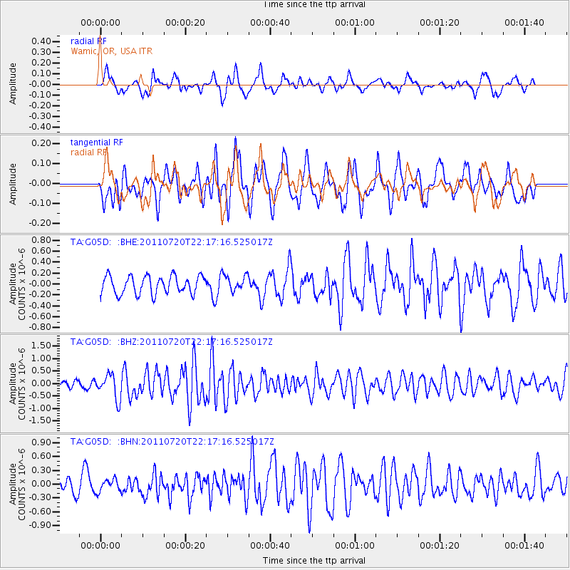
G05D Wamic, OR, USA - Earthquake Result Viewer
*The percent match for this event was below the threshold and hence no stack was calculated.
| Earthquake location: |
Solomon Islands |
| Earthquake latitude/longitude: |
-10.3/162.0 |
| Earthquake time(UTC): |
2011/07/20 (201) 22:04:59 GMT |
| Earthquake Depth: |
21 km |
| Earthquake Magnitude: |
5.9 MB, 5.6 MS, 6.0 MW, 6.0 MW |
| Earthquake Catalog/Contributor: |
WHDF/NEIC |
|
| Network: |
TA USArray Transportable Network (new EarthScope stations) |
| Station: |
G05D Wamic, OR, USA |
| Lat/Lon: |
45.24 N/121.32 W |
| Elevation: |
592 m |
|
| Distance: |
88.0 deg |
| Az: |
43.461 deg |
| Baz: |
253.341 deg |
| Ray Param: |
$rayparam |
*The percent match for this event was below the threshold and hence was not used in the summary stack. |
|
| Radial Match: |
55.596813 % |
| Radial Bump: |
400 |
| Transverse Match: |
59.882046 % |
| Transverse Bump: |
400 |
| SOD ConfigId: |
401841 |
| Insert Time: |
2011-12-21 06:44:45.092 +0000 |
| GWidth: |
2.5 |
| Max Bumps: |
400 |
| Tol: |
0.001 |
|
Signal To Noise
| Channel | StoN | STA | LTA |
| TA:G05D: :BHZ:20110720T22:17:16.525017Z | 2.4710538 | 5.022907E-7 | 2.0326983E-7 |
| TA:G05D: :BHN:20110720T22:17:16.525017Z | 0.8048356 | 1.3847409E-7 | 1.7205265E-7 |
| TA:G05D: :BHE:20110720T22:17:16.525017Z | 0.84243494 | 1.3826799E-7 | 1.6412899E-7 |
| Arrivals |
| Ps | |
| PpPs | |
| PsPs/PpSs | |


