You are here: Home > Network List > UW - Pacific Northwest Regional Seismic Network Stations List
> Station HEBO Mt. Hebo, OR CREST BB SMO > Earthquake Result Viewer
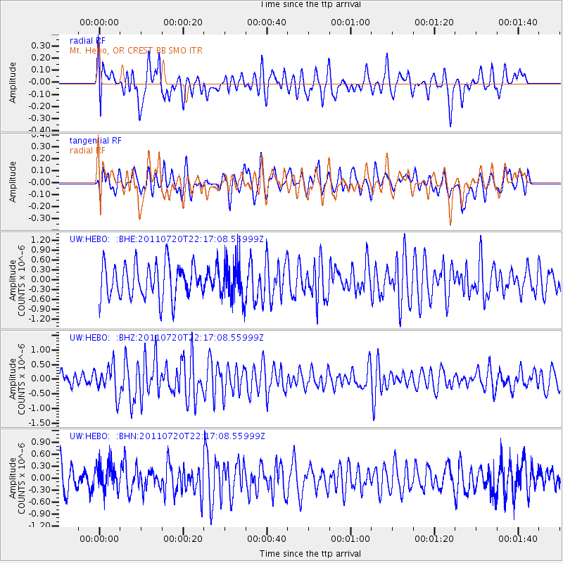
HEBO Mt. Hebo, OR CREST BB SMO - Earthquake Result Viewer
*The percent match for this event was below the threshold and hence no stack was calculated.
| Earthquake location: |
Solomon Islands |
| Earthquake latitude/longitude: |
-10.3/162.0 |
| Earthquake time(UTC): |
2011/07/20 (201) 22:04:59 GMT |
| Earthquake Depth: |
21 km |
| Earthquake Magnitude: |
5.9 MB, 5.6 MS, 6.0 MW, 6.0 MW |
| Earthquake Catalog/Contributor: |
WHDF/NEIC |
|
| Network: |
UW Pacific Northwest Regional Seismic Network |
| Station: |
HEBO Mt. Hebo, OR CREST BB SMO |
| Lat/Lon: |
45.21 N/123.76 W |
| Elevation: |
875 m |
|
| Distance: |
86.4 deg |
| Az: |
42.969 deg |
| Baz: |
251.592 deg |
| Ray Param: |
$rayparam |
*The percent match for this event was below the threshold and hence was not used in the summary stack. |
|
| Radial Match: |
50.83785 % |
| Radial Bump: |
400 |
| Transverse Match: |
57.19303 % |
| Transverse Bump: |
400 |
| SOD ConfigId: |
401841 |
| Insert Time: |
2011-12-21 06:48:28.254 +0000 |
| GWidth: |
2.5 |
| Max Bumps: |
400 |
| Tol: |
0.001 |
|
Signal To Noise
| Channel | StoN | STA | LTA |
| UW:HEBO: :BHZ:20110720T22:17:08.55999Z | 1.7716075 | 5.018409E-7 | 2.8326863E-7 |
| UW:HEBO: :BHN:20110720T22:17:08.55999Z | 1.333219 | 3.3238584E-7 | 2.4931074E-7 |
| UW:HEBO: :BHE:20110720T22:17:08.55999Z | 1.1118815 | 5.726297E-7 | 5.150096E-7 |
| Arrivals |
| Ps | |
| PpPs | |
| PsPs/PpSs | |


