You are here: Home > Network List > G - GEOSCOPE Stations List
> Station CAN Canberra, Australia > Earthquake Result Viewer
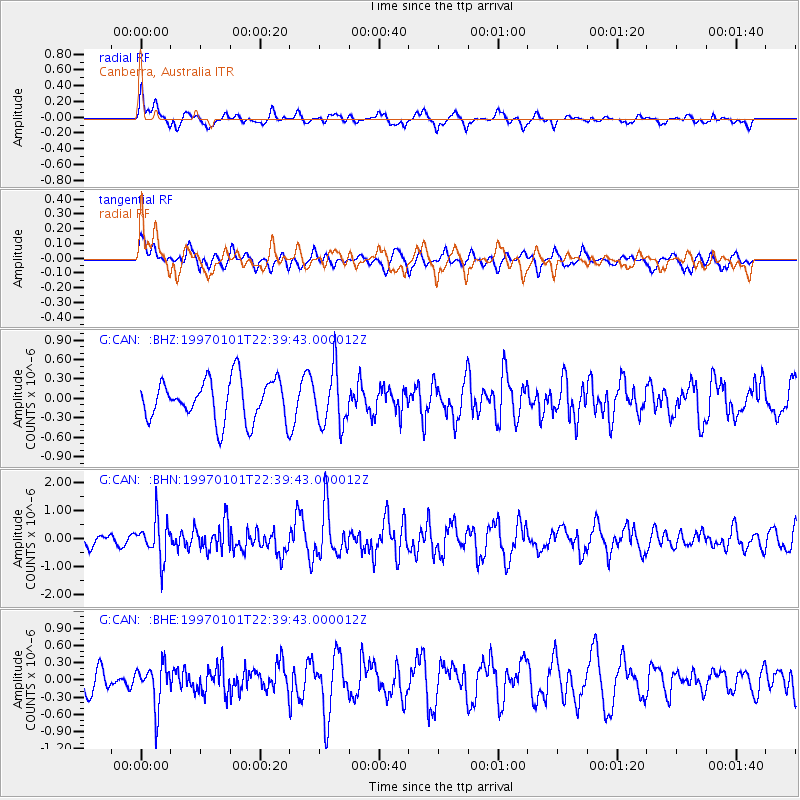
CAN Canberra, Australia - Earthquake Result Viewer
*The percent match for this event was below the threshold and hence no stack was calculated.
| Earthquake location: |
Minahassa Peninsula, Sulawesi |
| Earthquake latitude/longitude: |
-0.1/123.8 |
| Earthquake time(UTC): |
1997/01/01 (001) 22:32:32 GMT |
| Earthquake Depth: |
115 km |
| Earthquake Magnitude: |
5.9 MB, 5.8 UNKNOWN, 5.7 MW |
| Earthquake Catalog/Contributor: |
WHDF/NEIC |
|
| Network: |
G GEOSCOPE |
| Station: |
CAN Canberra, Australia |
| Lat/Lon: |
35.32 S/149.00 E |
| Elevation: |
650 m |
|
| Distance: |
42.2 deg |
| Az: |
148.779 deg |
| Baz: |
320.665 deg |
| Ray Param: |
$rayparam |
*The percent match for this event was below the threshold and hence was not used in the summary stack. |
|
| Radial Match: |
55.53915 % |
| Radial Bump: |
400 |
| Transverse Match: |
55.56565 % |
| Transverse Bump: |
400 |
| SOD ConfigId: |
4480 |
| Insert Time: |
2010-02-26 21:46:38.842 +0000 |
| GWidth: |
2.5 |
| Max Bumps: |
400 |
| Tol: |
0.001 |
|
Signal To Noise
| Channel | StoN | STA | LTA |
| G:CAN: :BHN:19970101T22:39:43.000012Z | 2.3710318 | 6.936513E-7 | 2.925525E-7 |
| G:CAN: :BHE:19970101T22:39:43.000012Z | 1.5806277 | 3.6595964E-7 | 2.3152803E-7 |
| G:CAN: :BHZ:19970101T22:39:43.000012Z | 1.3701929 | 4.3643044E-7 | 3.1851752E-7 |
| Arrivals |
| Ps | |
| PpPs | |
| PsPs/PpSs | |


