You are here: Home > Network List > CI - Caltech Regional Seismic Network Stations List
> Station GLA Glamis, Glamis, CA, USA > Earthquake Result Viewer
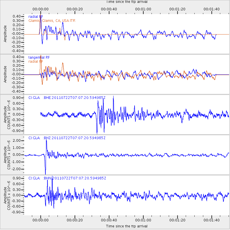
GLA Glamis, Glamis, CA, USA - Earthquake Result Viewer
*The percent match for this event was below the threshold and hence no stack was calculated.
| Earthquake location: |
Fiji Islands Region |
| Earthquake latitude/longitude: |
-20.3/-178.6 |
| Earthquake time(UTC): |
2011/07/22 (203) 06:56:40 GMT |
| Earthquake Depth: |
612 km |
| Earthquake Magnitude: |
5.9 MB, 6.0 MW, 5.9 MW |
| Earthquake Catalog/Contributor: |
WHDF/NEIC |
|
| Network: |
CI Caltech Regional Seismic Network |
| Station: |
GLA Glamis, Glamis, CA, USA |
| Lat/Lon: |
33.05 N/114.83 W |
| Elevation: |
610 m |
|
| Distance: |
80.7 deg |
| Az: |
49.757 deg |
| Baz: |
238.535 deg |
| Ray Param: |
$rayparam |
*The percent match for this event was below the threshold and hence was not used in the summary stack. |
|
| Radial Match: |
62.48111 % |
| Radial Bump: |
400 |
| Transverse Match: |
61.950172 % |
| Transverse Bump: |
400 |
| SOD ConfigId: |
401841 |
| Insert Time: |
2011-12-21 07:06:34.559 +0000 |
| GWidth: |
2.5 |
| Max Bumps: |
400 |
| Tol: |
0.001 |
|
Signal To Noise
| Channel | StoN | STA | LTA |
| CI:GLA: :BHZ:20110722T07:07:20.594985Z | 14.51706 | 8.493586E-7 | 5.8507617E-8 |
| CI:GLA: :BHN:20110722T07:07:20.594985Z | 2.6655338 | 2.3681886E-7 | 8.8844814E-8 |
| CI:GLA: :BHE:20110722T07:07:20.594985Z | 4.8352 | 3.488805E-7 | 7.2154315E-8 |
| Arrivals |
| Ps | |
| PpPs | |
| PsPs/PpSs | |


