You are here: Home > Network List > TA - USArray Transportable Network (new EarthScope stations) Stations List
> Station K22A Casper, WY, USA > Earthquake Result Viewer
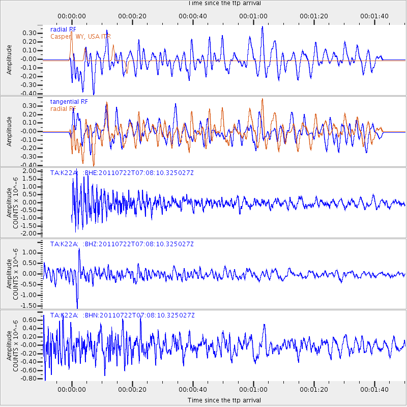
K22A Casper, WY, USA - Earthquake Result Viewer
*The percent match for this event was below the threshold and hence no stack was calculated.
| Earthquake location: |
Fiji Islands Region |
| Earthquake latitude/longitude: |
-20.3/-178.6 |
| Earthquake time(UTC): |
2011/07/22 (203) 06:56:40 GMT |
| Earthquake Depth: |
612 km |
| Earthquake Magnitude: |
5.9 MB, 6.0 MW, 5.9 MW |
| Earthquake Catalog/Contributor: |
WHDF/NEIC |
|
| Network: |
TA USArray Transportable Network (new EarthScope stations) |
| Station: |
K22A Casper, WY, USA |
| Lat/Lon: |
42.65 N/106.52 W |
| Elevation: |
1686 m |
|
| Distance: |
91.1 deg |
| Az: |
44.594 deg |
| Baz: |
243.265 deg |
| Ray Param: |
$rayparam |
*The percent match for this event was below the threshold and hence was not used in the summary stack. |
|
| Radial Match: |
58.836903 % |
| Radial Bump: |
400 |
| Transverse Match: |
46.55399 % |
| Transverse Bump: |
400 |
| SOD ConfigId: |
401841 |
| Insert Time: |
2011-12-21 07:20:02.974 +0000 |
| GWidth: |
2.5 |
| Max Bumps: |
400 |
| Tol: |
0.001 |
|
Signal To Noise
| Channel | StoN | STA | LTA |
| TA:K22A: :BHZ:20110722T07:08:10.325027Z | 1.6720238 | 5.373655E-7 | 3.213863E-7 |
| TA:K22A: :BHN:20110722T07:08:10.325027Z | 0.46123043 | 2.4291592E-7 | 5.2666934E-7 |
| TA:K22A: :BHE:20110722T07:08:10.325027Z | 0.41047138 | 2.66364E-7 | 6.4892225E-7 |
| Arrivals |
| Ps | |
| PpPs | |
| PsPs/PpSs | |


