You are here: Home > Network List > TA - USArray Transportable Network (new EarthScope stations) Stations List
> Station G03D McMinnville, OR, USA > Earthquake Result Viewer
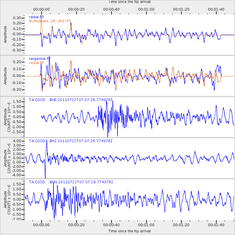
G03D McMinnville, OR, USA - Earthquake Result Viewer
*The percent match for this event was below the threshold and hence no stack was calculated.
| Earthquake location: |
Fiji Islands Region |
| Earthquake latitude/longitude: |
-20.3/-178.6 |
| Earthquake time(UTC): |
2011/07/22 (203) 06:56:40 GMT |
| Earthquake Depth: |
612 km |
| Earthquake Magnitude: |
5.9 MB, 6.0 MW, 5.9 MW |
| Earthquake Catalog/Contributor: |
WHDF/NEIC |
|
| Network: |
TA USArray Transportable Network (new EarthScope stations) |
| Station: |
G03D McMinnville, OR, USA |
| Lat/Lon: |
45.21 N/123.26 W |
| Elevation: |
222 m |
|
| Distance: |
82.4 deg |
| Az: |
35.915 deg |
| Baz: |
231.15 deg |
| Ray Param: |
$rayparam |
*The percent match for this event was below the threshold and hence was not used in the summary stack. |
|
| Radial Match: |
56.912373 % |
| Radial Bump: |
400 |
| Transverse Match: |
67.15494 % |
| Transverse Bump: |
400 |
| SOD ConfigId: |
401841 |
| Insert Time: |
2011-12-21 07:22:16.845 +0000 |
| GWidth: |
2.5 |
| Max Bumps: |
400 |
| Tol: |
0.001 |
|
Signal To Noise
| Channel | StoN | STA | LTA |
| TA:G03D: :BHZ:20110722T07:07:28.774978Z | 3.8980327 | 1.6232307E-6 | 4.1642306E-7 |
| TA:G03D: :BHN:20110722T07:07:28.774978Z | 2.0226076 | 5.420611E-7 | 2.6800114E-7 |
| TA:G03D: :BHE:20110722T07:07:28.774978Z | 1.5156147 | 4.5204138E-7 | 2.982561E-7 |
| Arrivals |
| Ps | |
| PpPs | |
| PsPs/PpSs | |


