You are here: Home > Network List > TA - USArray Transportable Network (new EarthScope stations) Stations List
> Station L02D Cave Junction, OR, USA > Earthquake Result Viewer
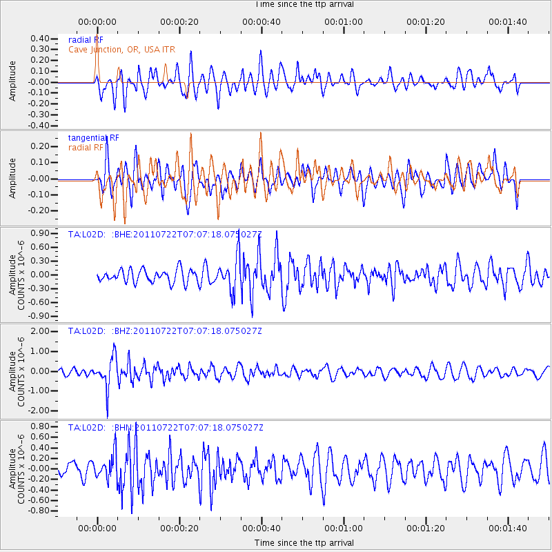
L02D Cave Junction, OR, USA - Earthquake Result Viewer
*The percent match for this event was below the threshold and hence no stack was calculated.
| Earthquake location: |
Fiji Islands Region |
| Earthquake latitude/longitude: |
-20.3/-178.6 |
| Earthquake time(UTC): |
2011/07/22 (203) 06:56:40 GMT |
| Earthquake Depth: |
612 km |
| Earthquake Magnitude: |
5.9 MB, 6.0 MW, 5.9 MW |
| Earthquake Catalog/Contributor: |
WHDF/NEIC |
|
| Network: |
TA USArray Transportable Network (new EarthScope stations) |
| Station: |
L02D Cave Junction, OR, USA |
| Lat/Lon: |
42.16 N/123.60 W |
| Elevation: |
458 m |
|
| Distance: |
80.2 deg |
| Az: |
38.166 deg |
| Baz: |
231.258 deg |
| Ray Param: |
$rayparam |
*The percent match for this event was below the threshold and hence was not used in the summary stack. |
|
| Radial Match: |
72.73058 % |
| Radial Bump: |
400 |
| Transverse Match: |
61.855854 % |
| Transverse Bump: |
400 |
| SOD ConfigId: |
401841 |
| Insert Time: |
2011-12-21 07:23:31.562 +0000 |
| GWidth: |
2.5 |
| Max Bumps: |
400 |
| Tol: |
0.001 |
|
Signal To Noise
| Channel | StoN | STA | LTA |
| TA:L02D: :BHZ:20110722T07:07:18.075027Z | 4.361342 | 7.748378E-7 | 1.7766043E-7 |
| TA:L02D: :BHN:20110722T07:07:18.075027Z | 1.1634939 | 2.383678E-7 | 2.048724E-7 |
| TA:L02D: :BHE:20110722T07:07:18.075027Z | 2.6973376 | 3.7103624E-7 | 1.3755647E-7 |
| Arrivals |
| Ps | |
| PpPs | |
| PsPs/PpSs | |


