You are here: Home > Network List > TA - USArray Transportable Network (new EarthScope stations) Stations List
> Station O03D Paynes Creek, CA, USA > Earthquake Result Viewer
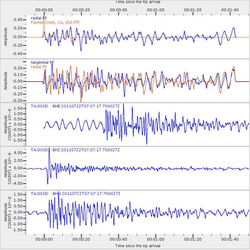
O03D Paynes Creek, CA, USA - Earthquake Result Viewer
*The percent match for this event was below the threshold and hence no stack was calculated.
| Earthquake location: |
Fiji Islands Region |
| Earthquake latitude/longitude: |
-20.3/-178.6 |
| Earthquake time(UTC): |
2011/07/22 (203) 06:56:40 GMT |
| Earthquake Depth: |
612 km |
| Earthquake Magnitude: |
5.9 MB, 6.0 MW, 5.9 MW |
| Earthquake Catalog/Contributor: |
WHDF/NEIC |
|
| Network: |
TA USArray Transportable Network (new EarthScope stations) |
| Station: |
O03D Paynes Creek, CA, USA |
| Lat/Lon: |
40.29 N/121.80 W |
| Elevation: |
968 m |
|
| Distance: |
80.2 deg |
| Az: |
40.503 deg |
| Baz: |
232.838 deg |
| Ray Param: |
$rayparam |
*The percent match for this event was below the threshold and hence was not used in the summary stack. |
|
| Radial Match: |
66.04522 % |
| Radial Bump: |
400 |
| Transverse Match: |
80.41752 % |
| Transverse Bump: |
400 |
| SOD ConfigId: |
401841 |
| Insert Time: |
2011-12-21 07:26:50.719 +0000 |
| GWidth: |
2.5 |
| Max Bumps: |
400 |
| Tol: |
0.001 |
|
Signal To Noise
| Channel | StoN | STA | LTA |
| TA:O03D: :BHZ:20110722T07:07:17.700027Z | 16.26221 | 1.9337808E-6 | 1.1891254E-7 |
| TA:O03D: :BHN:20110722T07:07:17.700027Z | 4.4834948 | 4.87763E-7 | 1.0879079E-7 |
| TA:O03D: :BHE:20110722T07:07:17.700027Z | 2.0491798 | 5.9579025E-7 | 2.9074573E-7 |
| Arrivals |
| Ps | |
| PpPs | |
| PsPs/PpSs | |


