You are here: Home > Network List > UW - Pacific Northwest Regional Seismic Network Stations List
> Station MRBL Marblemount, WA, USA > Earthquake Result Viewer
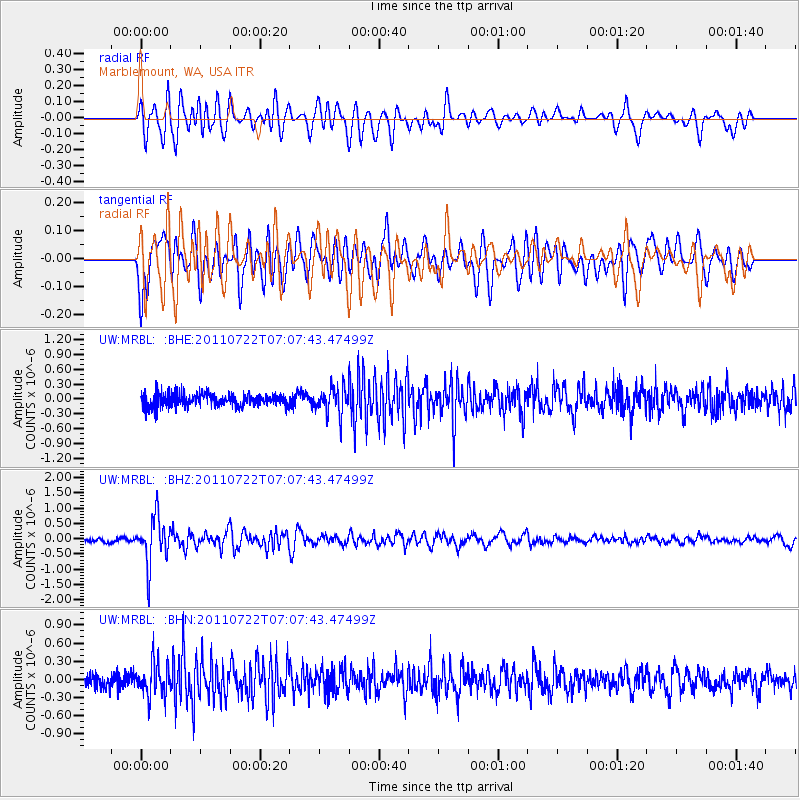
MRBL Marblemount, WA, USA - Earthquake Result Viewer
*The percent match for this event was below the threshold and hence no stack was calculated.
| Earthquake location: |
Fiji Islands Region |
| Earthquake latitude/longitude: |
-20.3/-178.6 |
| Earthquake time(UTC): |
2011/07/22 (203) 06:56:40 GMT |
| Earthquake Depth: |
612 km |
| Earthquake Magnitude: |
5.9 MB, 6.0 MW, 5.9 MW |
| Earthquake Catalog/Contributor: |
WHDF/NEIC |
|
| Network: |
UW Pacific Northwest Regional Seismic Network |
| Station: |
MRBL Marblemount, WA, USA |
| Lat/Lon: |
48.52 N/121.48 W |
| Elevation: |
75 m |
|
| Distance: |
85.4 deg |
| Az: |
34.066 deg |
| Baz: |
232.248 deg |
| Ray Param: |
$rayparam |
*The percent match for this event was below the threshold and hence was not used in the summary stack. |
|
| Radial Match: |
65.25098 % |
| Radial Bump: |
400 |
| Transverse Match: |
56.86147 % |
| Transverse Bump: |
400 |
| SOD ConfigId: |
401841 |
| Insert Time: |
2011-12-21 07:31:02.543 +0000 |
| GWidth: |
2.5 |
| Max Bumps: |
400 |
| Tol: |
0.001 |
|
Signal To Noise
| Channel | StoN | STA | LTA |
| UW:MRBL: :BHZ:20110722T07:07:43.47499Z | 8.622162 | 7.530278E-7 | 8.733631E-8 |
| UW:MRBL: :BHN:20110722T07:07:43.47499Z | 2.1496363 | 2.7005535E-7 | 1.256284E-7 |
| UW:MRBL: :BHE:20110722T07:07:43.47499Z | 2.1613626 | 2.7731963E-7 | 1.2830778E-7 |
| Arrivals |
| Ps | |
| PpPs | |
| PsPs/PpSs | |


