MDM Murphy Dome - Earthquake Result Viewer
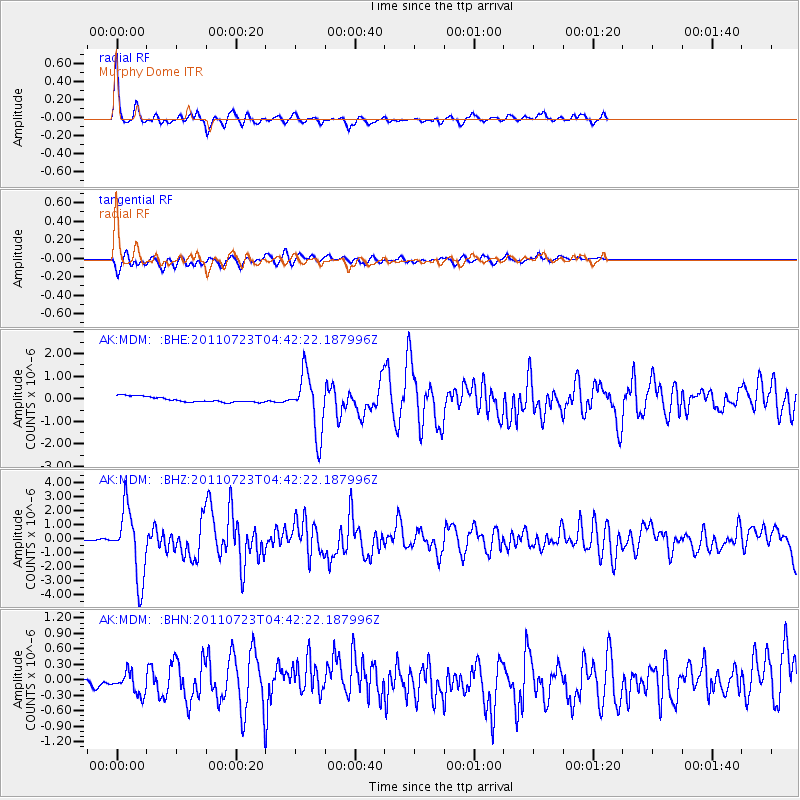
Earthquake location: Near East Coast Of Honshu, Japan
Earthquake latitude/longitude: 38.9/141.8
Earthquake time(UTC): 2011/07/23 (204) 04:34:24 GMT
Earthquake Depth: 41 km
Earthquake Magnitude: 5.9 MB, 5.9 MS, 6.4 MW, 6.3 MW
Earthquake Catalog/Contributor: WHDF/NEIC
Network: AK Alaska Regional Network
Station: MDM Murphy Dome
Lat/Lon: 64.96 N/148.23 W
Elevation: 634 m
Distance: 47.2 deg
Az: 33.034 deg
Baz: 271.887 deg
Ray Param: 0.07006578
Estimated Moho Depth: 33.0 km
Estimated Crust Vp/Vs: 1.60
Assumed Crust Vp: 6.566 km/s
Estimated Crust Vs: 4.104 km/s
Estimated Crust Poisson's Ratio: 0.18
Radial Match: 92.20286 %
Radial Bump: 369
Transverse Match: 77.737236 %
Transverse Bump: 400
SOD ConfigId: 405110
Insert Time: 2011-12-29 04:27:35.803 +0000
GWidth: 2.5
Max Bumps: 400
Tol: 0.001

Signal To Noise

ChannelStoNSTALTA
AK:MDM: :BHZ:20110723T04:42:22.187996Z42.140652.4578103E-65.8323973E-8
AK:MDM: :BHN:20110723T04:42:22.187996Z3.2657772.1252241E-76.5075604E-8
AK:MDM: :BHE:20110723T04:42:22.187996Z10.8928721.3004101E-61.1938175E-7
Arrivals
Ps3.2 SECOND
PpPs12 SECOND
PsPs/PpSs15 SECOND