
T25A Trinidad, CO, USA - Earthquake Result Viewer
| ||||||||||||||||||
| ||||||||||||||||||
| ||||||||||||||||||
|
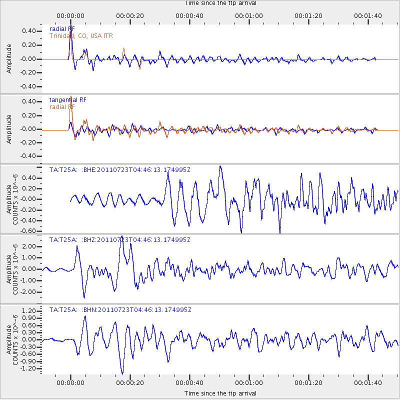
Signal To Noise
| Channel | StoN | STA | LTA |
| TA:T25A: :BHZ:20110723T04:46:13.174995Z | 10.744231 | 1.1469932E-6 | 1.0675433E-7 |
| TA:T25A: :BHN:20110723T04:46:13.174995Z | 5.581946 | 3.9557733E-7 | 7.086728E-8 |
| TA:T25A: :BHE:20110723T04:46:13.174995Z | 3.4291492 | 2.388481E-7 | 6.965229E-8 |
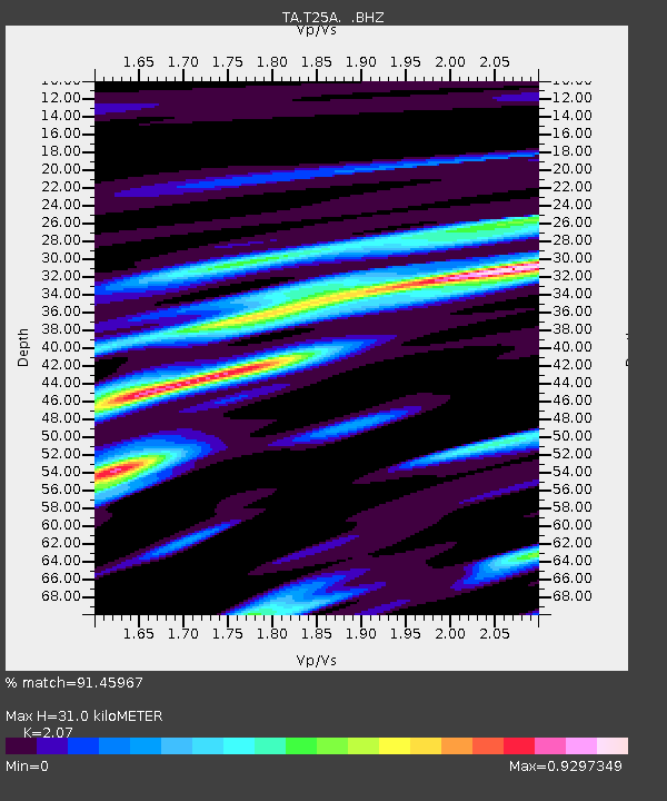
| Arrivals | |
| Ps | 5.4 SECOND |
| PpPs | 15 SECOND |
| PsPs/PpSs | 20 SECOND |

