Q24A Divide, CO, USA - Earthquake Result Viewer
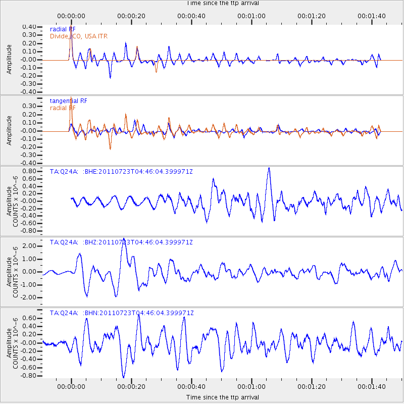
Earthquake location: Near East Coast Of Honshu, Japan
Earthquake latitude/longitude: 38.9/141.8
Earthquake time(UTC): 2011/07/23 (204) 04:34:24 GMT
Earthquake Depth: 41 km
Earthquake Magnitude: 5.9 MB, 5.9 MS, 6.4 MW, 6.3 MW
Earthquake Catalog/Contributor: WHDF/NEIC
Network: TA USArray Transportable Network (new EarthScope stations)
Station: Q24A Divide, CO, USA
Lat/Lon: 38.96 N/105.15 W
Elevation: 2775 m
Distance: 81.2 deg
Az: 46.556 deg
Baz: 313.388 deg
Ray Param: 0.04771407
Estimated Moho Depth: 39.5 km
Estimated Crust Vp/Vs: 1.90
Assumed Crust Vp: 6.159 km/s
Estimated Crust Vs: 3.241 km/s
Estimated Crust Poisson's Ratio: 0.31
Radial Match: 90.71832 %
Radial Bump: 400
Transverse Match: 77.368675 %
Transverse Bump: 400
SOD ConfigId: 405110
Insert Time: 2011-12-29 04:47:39.552 +0000
GWidth: 2.5
Max Bumps: 400
Tol: 0.001

Signal To Noise

ChannelStoNSTALTA
TA:Q24A: :BHZ:20110723T04:46:04.399971Z10.1259538.579739E-78.473019E-8
TA:Q24A: :BHN:20110723T04:46:04.399971Z3.0825732.7152836E-78.808498E-8
TA:Q24A: :BHE:20110723T04:46:04.399971Z1.60493621.5057032E-79.381701E-8
Arrivals
Ps5.9 SECOND
PpPs18 SECOND
PsPs/PpSs24 SECOND