MDND Maddock, ND, USA - Earthquake Result Viewer
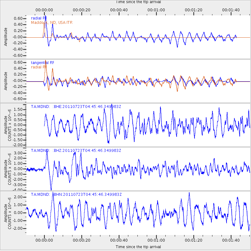
Earthquake location: Near East Coast Of Honshu, Japan
Earthquake latitude/longitude: 38.9/141.8
Earthquake time(UTC): 2011/07/23 (204) 04:34:24 GMT
Earthquake Depth: 41 km
Earthquake Magnitude: 5.9 MB, 5.9 MS, 6.4 MW, 6.3 MW
Earthquake Catalog/Contributor: WHDF/NEIC
Network: TA USArray Transportable Network (new EarthScope stations)
Station: MDND Maddock, ND, USA
Lat/Lon: 47.85 N/99.60 W
Elevation: 479 m
Distance: 77.8 deg
Az: 37.235 deg
Baz: 315.495 deg
Ray Param: 0.04998722
Estimated Moho Depth: 32.5 km
Estimated Crust Vp/Vs: 1.87
Assumed Crust Vp: 6.53 km/s
Estimated Crust Vs: 3.488 km/s
Estimated Crust Poisson's Ratio: 0.30
Radial Match: 88.35305 %
Radial Bump: 400
Transverse Match: 67.29214 %
Transverse Bump: 400
SOD ConfigId: 405110
Insert Time: 2011-12-29 04:47:43.280 +0000
GWidth: 2.5
Max Bumps: 400
Tol: 0.001

Signal To Noise

ChannelStoNSTALTA
TA:MDND: :BHZ:20110723T04:45:46.349983Z10.5982291.9394324E-61.8299589E-7
TA:MDND: :BHN:20110723T04:45:46.349983Z1.93523431.1777278E-66.0857116E-7
TA:MDND: :BHE:20110723T04:45:46.349983Z1.54144499.77219E-76.3396294E-7
Arrivals
Ps4.5 SECOND
PpPs14 SECOND
PsPs/PpSs18 SECOND