
J05D Fort Rock, OR, USA - Earthquake Result Viewer
| ||||||||||||||||||
| ||||||||||||||||||
| ||||||||||||||||||
|
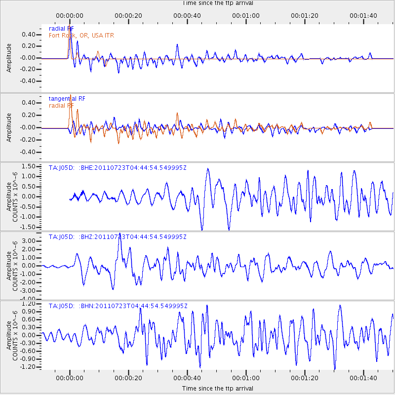
Signal To Noise
| Channel | StoN | STA | LTA |
| TA:J05D: :BHZ:20110723T04:44:54.549995Z | 7.3819265 | 9.329477E-7 | 1.2638269E-7 |
| TA:J05D: :BHN:20110723T04:44:54.549995Z | 0.9323071 | 2.045486E-7 | 2.1940045E-7 |
| TA:J05D: :BHE:20110723T04:44:54.549995Z | 1.8961512 | 3.3059146E-7 | 1.7434868E-7 |
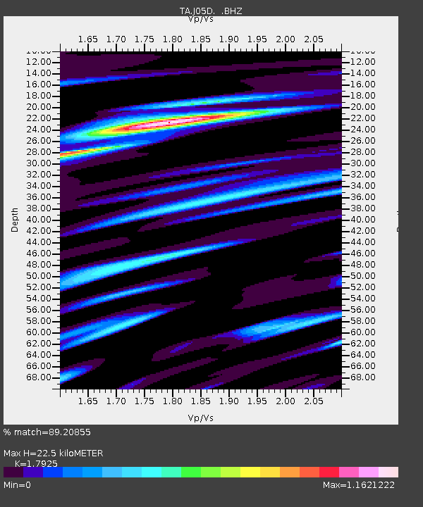
| Arrivals | |
| Ps | 2.8 SECOND |
| PpPs | 9.2 SECOND |
| PsPs/PpSs | 12 SECOND |

