
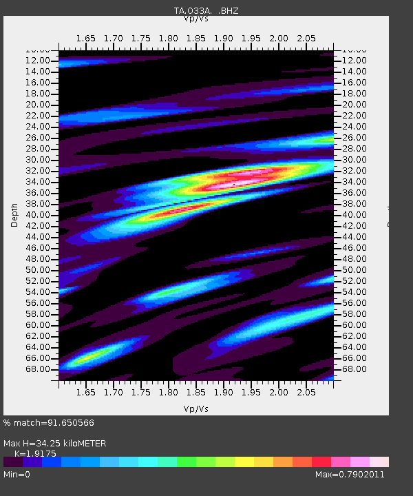
O33A Hebron, NE, USA - Earthquake Result Viewer
| ||||||||||||||||||
| ||||||||||||||||||
| ||||||||||||||||||
|
Signal To Noise
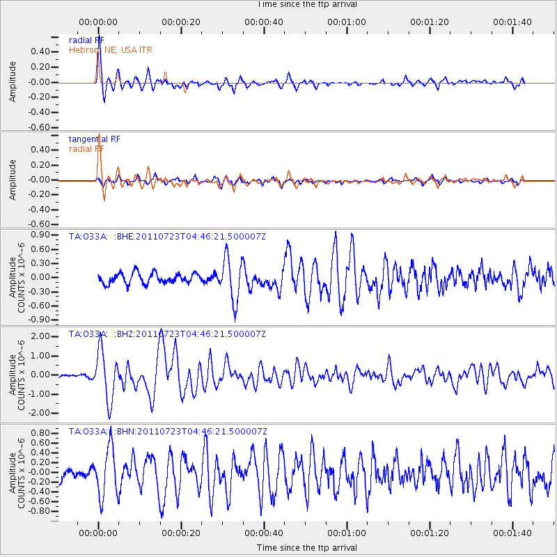
| Channel | StoN | STA | LTA |
| TA:O33A: :BHZ:20110723T04:46:21.500007Z | 17.055717 | 1.3022105E-6 | 7.6350375E-8 |
| TA:O33A: :BHN:20110723T04:46:21.500007Z | 2.9727771 | 5.06035E-7 | 1.7022299E-7 |
| TA:O33A: :BHE:20110723T04:46:21.500007Z | 4.2253165 | 4.5784054E-7 | 1.083565E-7 |
| Arrivals | |
| Ps | 5.0 SECOND |
| PpPs | 15 SECOND |
| PsPs/PpSs | 20 SECOND |

