
V36A Jenks, OK, USA - Earthquake Result Viewer
| ||||||||||||||||||
| ||||||||||||||||||
| ||||||||||||||||||
|
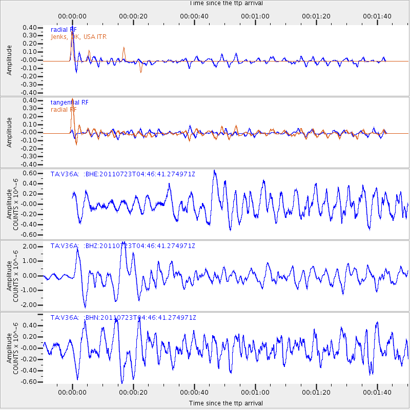
Signal To Noise
| Channel | StoN | STA | LTA |
| TA:V36A: :BHZ:20110723T04:46:41.274971Z | 6.972186 | 1.1410539E-6 | 1.6365799E-7 |
| TA:V36A: :BHN:20110723T04:46:41.274971Z | 2.1528225 | 2.9935785E-7 | 1.3905365E-7 |
| TA:V36A: :BHE:20110723T04:46:41.274971Z | 1.7010117 | 2.0887997E-7 | 1.2279749E-7 |
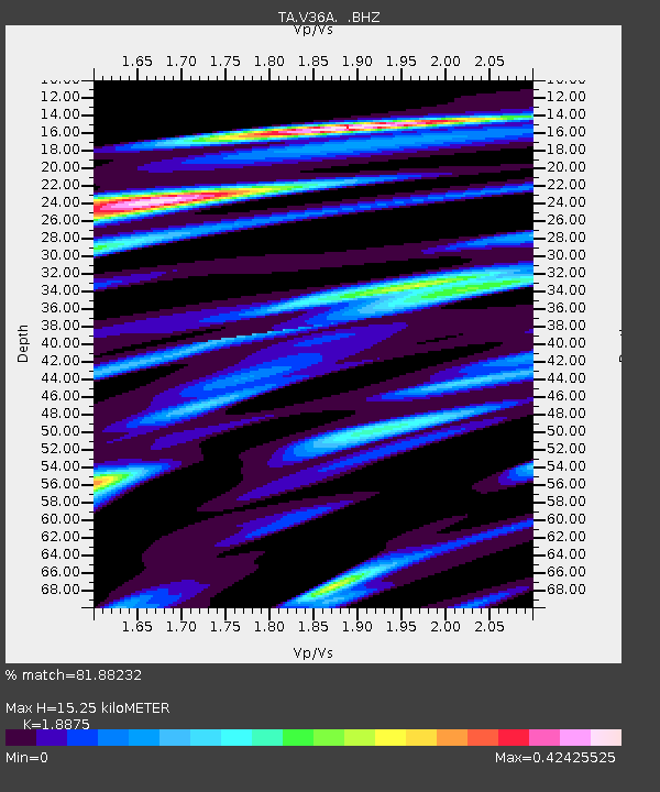
| Arrivals | |
| Ps | 2.1 SECOND |
| PpPs | 6.6 SECOND |
| PsPs/PpSs | 8.8 SECOND |

