U37A Salina, OK, USA - Earthquake Result Viewer
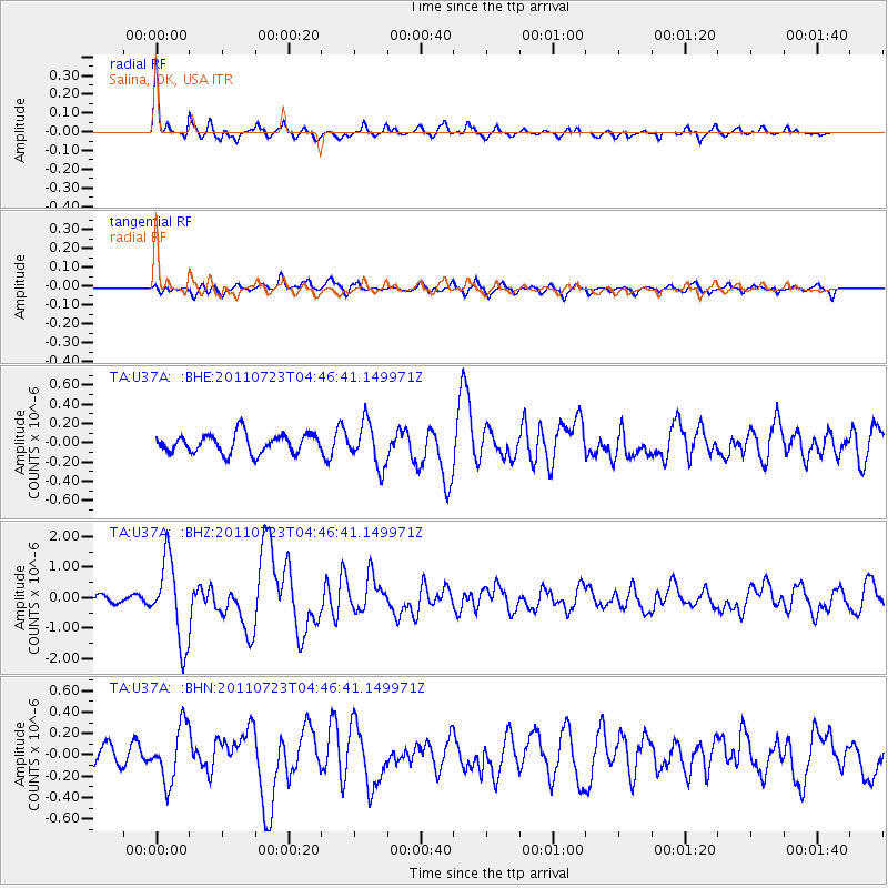
Earthquake location: Near East Coast Of Honshu, Japan
Earthquake latitude/longitude: 38.9/141.8
Earthquake time(UTC): 2011/07/23 (204) 04:34:24 GMT
Earthquake Depth: 41 km
Earthquake Magnitude: 5.9 MB, 5.9 MS, 6.4 MW, 6.3 MW
Earthquake Catalog/Contributor: WHDF/NEIC
Network: TA USArray Transportable Network (new EarthScope stations)
Station: U37A Salina, OK, USA
Lat/Lon: 36.41 N/95.12 W
Elevation: 248 m
Distance: 88.5 deg
Az: 42.554 deg
Baz: 319.145 deg
Ray Param: 0.042474557
Estimated Moho Depth: 48.25 km
Estimated Crust Vp/Vs: 1.68
Assumed Crust Vp: 6.53 km/s
Estimated Crust Vs: 3.899 km/s
Estimated Crust Poisson's Ratio: 0.22
Radial Match: 90.75967 %
Radial Bump: 297
Transverse Match: 68.79064 %
Transverse Bump: 400
SOD ConfigId: 405110
Insert Time: 2011-12-29 05:02:49.222 +0000
GWidth: 2.5
Max Bumps: 400
Tol: 0.001

Signal To Noise

ChannelStoNSTALTA
TA:U37A: :BHZ:20110723T04:46:41.149971Z10.4596331.3370646E-61.2783093E-7
TA:U37A: :BHN:20110723T04:46:41.149971Z2.75112132.6001675E-79.451301E-8
TA:U37A: :BHE:20110723T04:46:41.149971Z2.30567772.2716061E-79.852227E-8
Arrivals
Ps5.1 SECOND
PpPs19 SECOND
PsPs/PpSs24 SECOND