U35A Pawnee, OK, USA - Earthquake Result Viewer
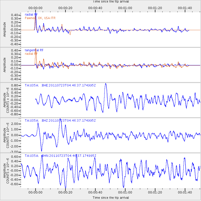
Earthquake location: Near East Coast Of Honshu, Japan
Earthquake latitude/longitude: 38.9/141.8
Earthquake time(UTC): 2011/07/23 (204) 04:34:24 GMT
Earthquake Depth: 41 km
Earthquake Magnitude: 5.9 MB, 5.9 MS, 6.4 MW, 6.3 MW
Earthquake Catalog/Contributor: WHDF/NEIC
Network: TA USArray Transportable Network (new EarthScope stations)
Station: U35A Pawnee, OK, USA
Lat/Lon: 36.37 N/96.73 W
Elevation: 303 m
Distance: 87.7 deg
Az: 43.557 deg
Baz: 318.224 deg
Ray Param: 0.04309395
Estimated Moho Depth: 38.0 km
Estimated Crust Vp/Vs: 1.90
Assumed Crust Vp: 6.483 km/s
Estimated Crust Vs: 3.407 km/s
Estimated Crust Poisson's Ratio: 0.31
Radial Match: 88.67875 %
Radial Bump: 400
Transverse Match: 70.86539 %
Transverse Bump: 400
SOD ConfigId: 405110
Insert Time: 2011-12-29 05:03:02.772 +0000
GWidth: 2.5
Max Bumps: 400
Tol: 0.001

Signal To Noise

ChannelStoNSTALTA
TA:U35A: :BHZ:20110723T04:46:37.174995Z7.4889951.3538665E-61.807808E-7
TA:U35A: :BHN:20110723T04:46:37.174995Z2.27510333.509254E-71.5424592E-7
TA:U35A: :BHE:20110723T04:46:37.174995Z1.62962442.7093836E-71.6625818E-7
Arrivals
Ps5.4 SECOND
PpPs17 SECOND
PsPs/PpSs22 SECOND