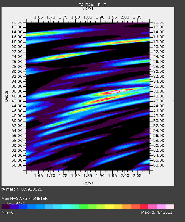
I34A Hadley, MN, USA - Earthquake Result Viewer
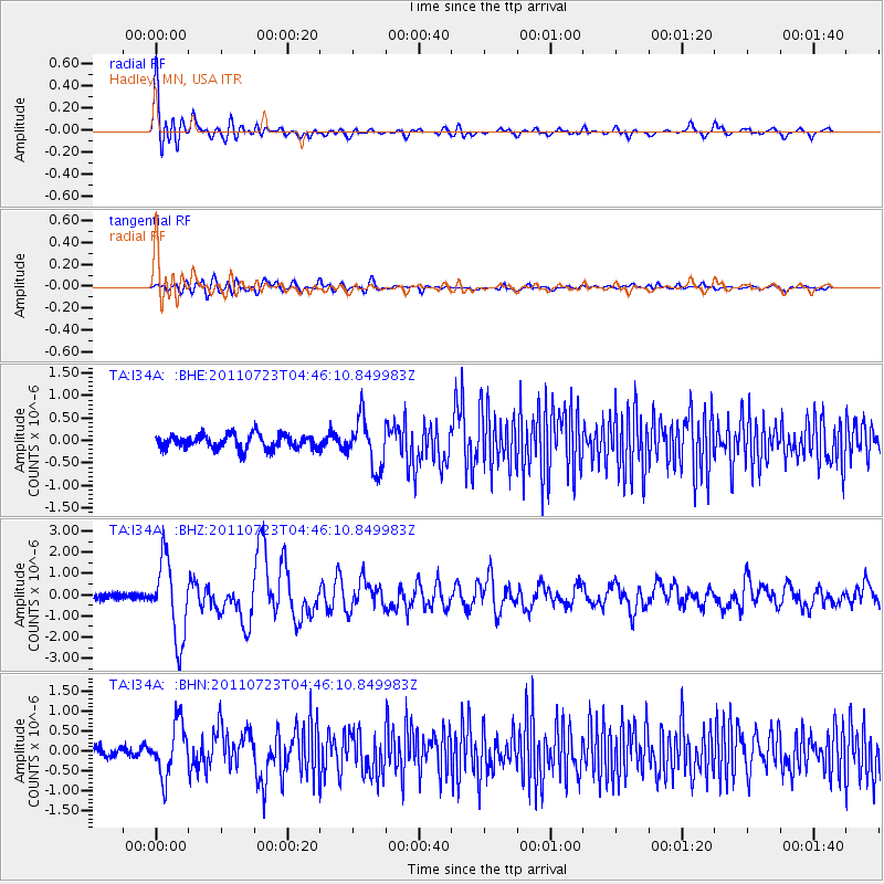
Earthquake location: Near East Coast Of Honshu, Japan
Earthquake latitude/longitude: 38.9/141.8
Earthquake time(UTC): 2011/07/23 (204) 04:34:24 GMT
Earthquake Depth: 41 km
Earthquake Magnitude: 5.9 MB, 5.9 MS, 6.4 MW, 6.3 MW
Earthquake Catalog/Contributor: WHDF/NEIC
Network: TA USArray Transportable Network (new EarthScope stations)
Station: I34A Hadley, MN, USA
Lat/Lon: 44.04 N/95.86 W
Elevation: 509 m
Distance: 82.4 deg
Az: 37.94 deg
Baz: 318.299 deg
Ray Param: 0.046852127
Estimated Moho Depth: 37.75 km
Estimated Crust Vp/Vs: 1.98
Assumed Crust Vp: 6.571 km/s
Estimated Crust Vs: 3.323 km/s
Estimated Crust Poisson's Ratio: 0.33
Radial Match: 87.918526 %
Radial Bump: 400
Transverse Match: 64.19958 %
Transverse Bump: 400
SOD ConfigId: 405110
Insert Time: 2011-12-29 05:03:52.607 +0000
GWidth: 2.5
Max Bumps: 400
Tol: 0.001

Signal To Noise

ChannelStoNSTALTA
TA:I34A: :BHZ:20110723T04:46:10.849983Z11.4603581.8306528E-61.5973784E-7
TA:I34A: :BHN:20110723T04:46:10.849983Z4.8149316.5527723E-71.3609277E-7
TA:I34A: :BHE:20110723T04:46:10.849983Z3.46290975.496252E-71.5871774E-7
Arrivals
Ps5.8 SECOND
PpPs17 SECOND
PsPs/PpSs22 SECOND