J31A Geddes, SD, USA - Earthquake Result Viewer
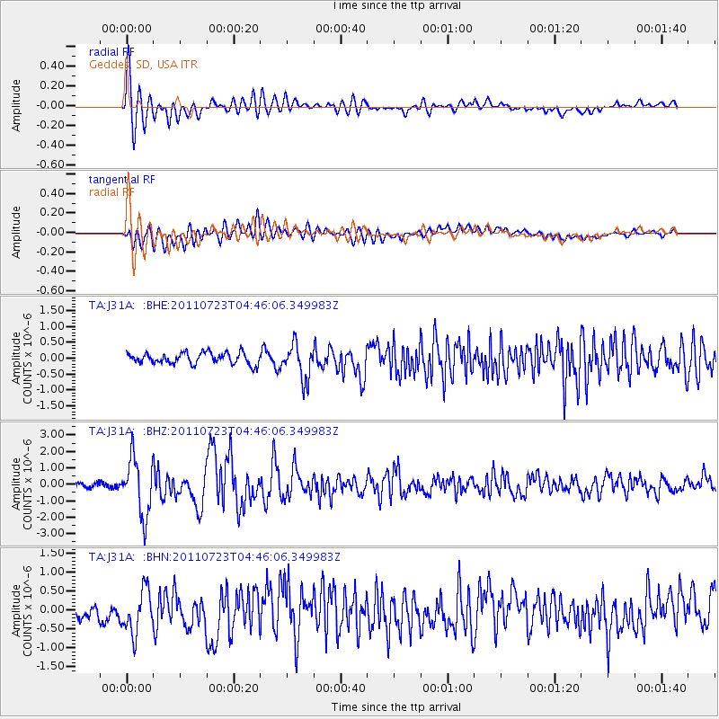
Earthquake location: Near East Coast Of Honshu, Japan
Earthquake latitude/longitude: 38.9/141.8
Earthquake time(UTC): 2011/07/23 (204) 04:34:24 GMT
Earthquake Depth: 41 km
Earthquake Magnitude: 5.9 MB, 5.9 MS, 6.4 MW, 6.3 MW
Earthquake Catalog/Contributor: WHDF/NEIC
Network: TA USArray Transportable Network (new EarthScope stations)
Station: J31A Geddes, SD, USA
Lat/Lon: 43.29 N/98.74 W
Elevation: 491 m
Distance: 81.5 deg
Az: 40.005 deg
Baz: 316.606 deg
Ray Param: 0.047453504
Estimated Moho Depth: 22.0 km
Estimated Crust Vp/Vs: 1.71
Assumed Crust Vp: 6.53 km/s
Estimated Crust Vs: 3.825 km/s
Estimated Crust Poisson's Ratio: 0.24
Radial Match: 87.41486 %
Radial Bump: 400
Transverse Match: 77.51818 %
Transverse Bump: 400
SOD ConfigId: 405110
Insert Time: 2011-12-29 05:04:43.031 +0000
GWidth: 2.5
Max Bumps: 400
Tol: 0.001

Signal To Noise

ChannelStoNSTALTA
TA:J31A: :BHZ:20110723T04:46:06.349983Z15.0632261.755363E-61.1653301E-7
TA:J31A: :BHN:20110723T04:46:06.349983Z3.23392725.9656406E-71.8447048E-7
TA:J31A: :BHE:20110723T04:46:06.349983Z3.08202085.5302115E-71.7943461E-7
Arrivals
Ps2.5 SECOND
PpPs8.9 SECOND
PsPs/PpSs11 SECOND