
O03D Paynes Creek, CA, USA - Earthquake Result Viewer
| ||||||||||||||||||
| ||||||||||||||||||
| ||||||||||||||||||
|
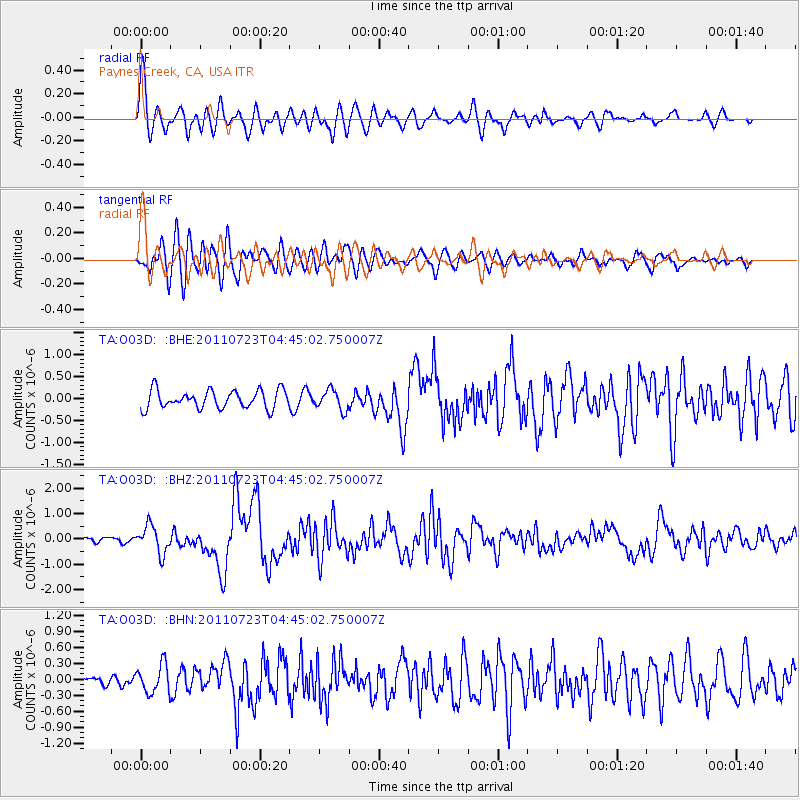
Signal To Noise
| Channel | StoN | STA | LTA |
| TA:O03D: :BHZ:20110723T04:45:02.750007Z | 6.8947673 | 5.442442E-7 | 7.893583E-8 |
| TA:O03D: :BHN:20110723T04:45:02.750007Z | 2.139943 | 2.6658785E-7 | 1.2457708E-7 |
| TA:O03D: :BHE:20110723T04:45:02.750007Z | 1.1052896 | 2.2890569E-7 | 2.071002E-7 |
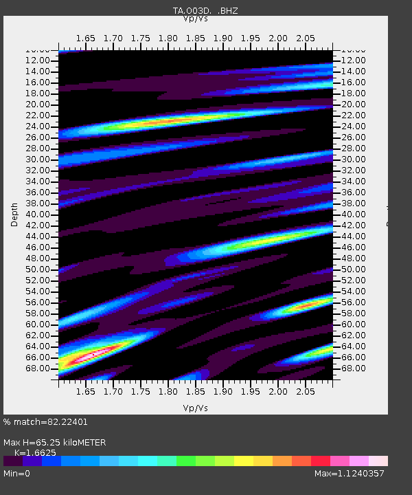
| Arrivals | |
| Ps | 6.9 SECOND |
| PpPs | 25 SECOND |
| PsPs/PpSs | 32 SECOND |

