E31A Nome, ND, USA - Earthquake Result Viewer
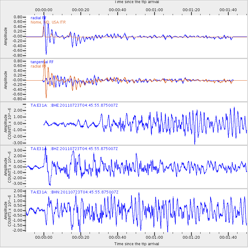
Earthquake location: Near East Coast Of Honshu, Japan
Earthquake latitude/longitude: 38.9/141.8
Earthquake time(UTC): 2011/07/23 (204) 04:34:24 GMT
Earthquake Depth: 41 km
Earthquake Magnitude: 5.9 MB, 5.9 MS, 6.4 MW, 6.3 MW
Earthquake Catalog/Contributor: WHDF/NEIC
Network: TA USArray Transportable Network (new EarthScope stations)
Station: E31A Nome, ND, USA
Lat/Lon: 46.56 N/97.89 W
Elevation: 427 m
Distance: 79.6 deg
Az: 37.287 deg
Baz: 316.76 deg
Ray Param: 0.048802838
Estimated Moho Depth: 14.0 km
Estimated Crust Vp/Vs: 2.09
Assumed Crust Vp: 6.498 km/s
Estimated Crust Vs: 3.109 km/s
Estimated Crust Poisson's Ratio: 0.35
Radial Match: 93.843834 %
Radial Bump: 392
Transverse Match: 86.74531 %
Transverse Bump: 400
SOD ConfigId: 405110
Insert Time: 2011-12-29 05:05:59.333 +0000
GWidth: 2.5
Max Bumps: 400
Tol: 0.001

Signal To Noise

ChannelStoNSTALTA
TA:E31A: :BHZ:20110723T04:45:55.875007Z16.5072121.8198273E-61.1024437E-7
TA:E31A: :BHN:20110723T04:45:55.875007Z3.85811737.1311126E-71.84834E-7
TA:E31A: :BHE:20110723T04:45:55.875007Z2.84962277.0400273E-72.4705122E-7
Arrivals
Ps2.4 SECOND
PpPs6.5 SECOND
PsPs/PpSs8.9 SECOND