
E35A Pequot Lakes, MN, USA - Earthquake Result Viewer
| ||||||||||||||||||
| ||||||||||||||||||
| ||||||||||||||||||
|
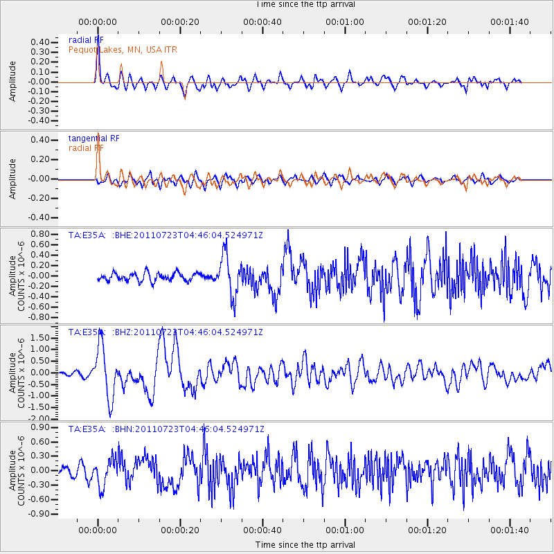
Signal To Noise
| Channel | StoN | STA | LTA |
| TA:E35A: :BHZ:20110723T04:46:04.524971Z | 12.694312 | 1.1436097E-6 | 9.0088356E-8 |
| TA:E35A: :BHN:20110723T04:46:04.524971Z | 1.6043628 | 2.827681E-7 | 1.7624947E-7 |
| TA:E35A: :BHE:20110723T04:46:04.524971Z | 5.1224847 | 3.9779607E-7 | 7.765686E-8 |
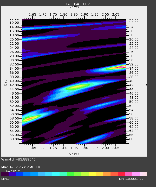
| Arrivals | |
| Ps | 5.7 SECOND |
| PpPs | 15 SECOND |
| PsPs/PpSs | 21 SECOND |

