D34A Park Rapids, MN, USA - Earthquake Result Viewer
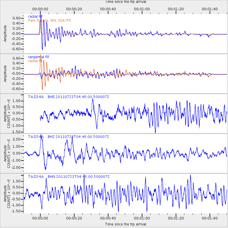
Earthquake location: Near East Coast Of Honshu, Japan
Earthquake latitude/longitude: 38.9/141.8
Earthquake time(UTC): 2011/07/23 (204) 04:34:24 GMT
Earthquake Depth: 41 km
Earthquake Magnitude: 5.9 MB, 5.9 MS, 6.4 MW, 6.3 MW
Earthquake Catalog/Contributor: WHDF/NEIC
Network: TA USArray Transportable Network (new EarthScope stations)
Station: D34A Park Rapids, MN, USA
Lat/Lon: 47.09 N/95.20 W
Elevation: 476 m
Distance: 80.4 deg
Az: 35.54 deg
Baz: 318.414 deg
Ray Param: 0.048216633
Estimated Moho Depth: 24.5 km
Estimated Crust Vp/Vs: 1.60
Assumed Crust Vp: 6.419 km/s
Estimated Crust Vs: 4.012 km/s
Estimated Crust Poisson's Ratio: 0.18
Radial Match: 82.55519 %
Radial Bump: 400
Transverse Match: 70.655914 %
Transverse Bump: 400
SOD ConfigId: 405110
Insert Time: 2011-12-29 05:07:03.603 +0000
GWidth: 2.5
Max Bumps: 400
Tol: 0.001

Signal To Noise

ChannelStoNSTALTA
TA:D34A: :BHZ:20110723T04:46:00.500007Z9.1917191.4098651E-61.5338428E-7
TA:D34A: :BHN:20110723T04:46:00.500007Z2.49515415.933449E-72.3779889E-7
TA:D34A: :BHE:20110723T04:46:00.500007Z2.8463516.3417394E-72.2280244E-7
Arrivals
Ps2.4 SECOND
PpPs9.6 SECOND
PsPs/PpSs12 SECOND