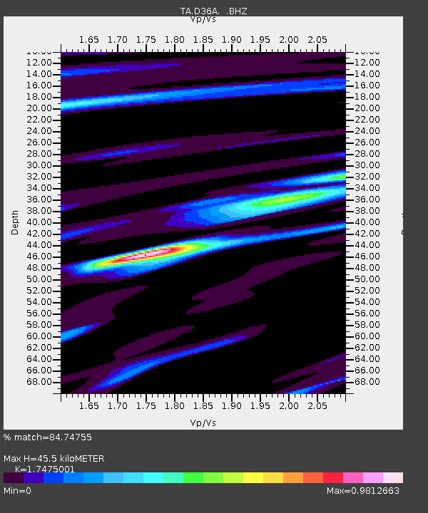
D36A Goodland, MN, USA - Earthquake Result Viewer
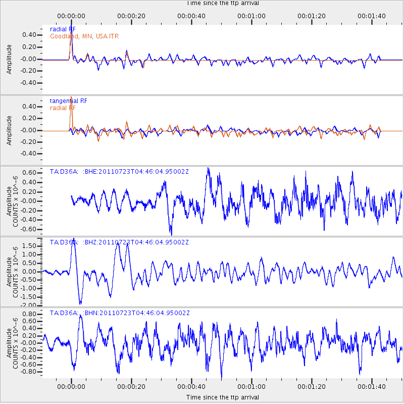
Earthquake location: Near East Coast Of Honshu, Japan
Earthquake latitude/longitude: 38.9/141.8
Earthquake time(UTC): 2011/07/23 (204) 04:34:24 GMT
Earthquake Depth: 41 km
Earthquake Magnitude: 5.9 MB, 5.9 MS, 6.4 MW, 6.3 MW
Earthquake Catalog/Contributor: WHDF/NEIC
Network: TA USArray Transportable Network (new EarthScope stations)
Station: D36A Goodland, MN, USA
Lat/Lon: 47.18 N/93.16 W
Elevation: 434 m
Distance: 81.3 deg
Az: 34.418 deg
Baz: 319.719 deg
Ray Param: 0.04763902
Estimated Moho Depth: 45.5 km
Estimated Crust Vp/Vs: 1.75
Assumed Crust Vp: 6.571 km/s
Estimated Crust Vs: 3.76 km/s
Estimated Crust Poisson's Ratio: 0.26
Radial Match: 84.74755 %
Radial Bump: 400
Transverse Match: 68.91671 %
Transverse Bump: 400
SOD ConfigId: 405110
Insert Time: 2011-12-29 05:07:40.802 +0000
GWidth: 2.5
Max Bumps: 400
Tol: 0.001

Signal To Noise

ChannelStoNSTALTA
TA:D36A: :BHZ:20110723T04:46:04.95002Z13.2758971.1888183E-68.9547115E-8
TA:D36A: :BHN:20110723T04:46:04.95002Z3.71556144.5817475E-71.2331239E-7
TA:D36A: :BHE:20110723T04:46:04.95002Z2.7505563.300665E-71.1999992E-7
Arrivals
Ps5.3 SECOND
PpPs18 SECOND
PsPs/PpSs24 SECOND