F36A Milaca, MN, USA - Earthquake Result Viewer
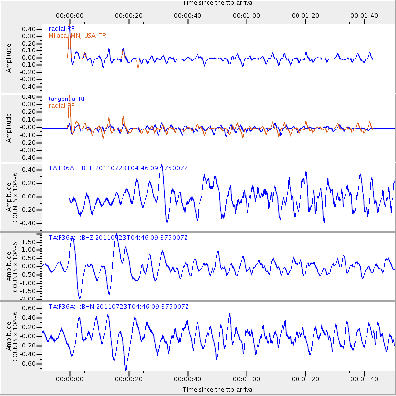
Earthquake location: Near East Coast Of Honshu, Japan
Earthquake latitude/longitude: 38.9/141.8
Earthquake time(UTC): 2011/07/23 (204) 04:34:24 GMT
Earthquake Depth: 41 km
Earthquake Magnitude: 5.9 MB, 5.9 MS, 6.4 MW, 6.3 MW
Earthquake Catalog/Contributor: WHDF/NEIC
Network: TA USArray Transportable Network (new EarthScope stations)
Station: F36A Milaca, MN, USA
Lat/Lon: 45.86 N/93.52 W
Elevation: 345 m
Distance: 82.1 deg
Az: 35.47 deg
Baz: 319.611 deg
Ray Param: 0.047049493
Estimated Moho Depth: 24.0 km
Estimated Crust Vp/Vs: 1.60
Assumed Crust Vp: 6.571 km/s
Estimated Crust Vs: 4.107 km/s
Estimated Crust Poisson's Ratio: 0.18
Radial Match: 83.35018 %
Radial Bump: 400
Transverse Match: 65.179184 %
Transverse Bump: 400
SOD ConfigId: 405110
Insert Time: 2011-12-29 05:08:23.278 +0000
GWidth: 2.5
Max Bumps: 400
Tol: 0.001

Signal To Noise

ChannelStoNSTALTA
TA:F36A: :BHZ:20110723T04:46:09.375007Z6.86452961.2267781E-61.7871261E-7
TA:F36A: :BHN:20110723T04:46:09.375007Z1.86014392.6305744E-71.414178E-7
TA:F36A: :BHE:20110723T04:46:09.375007Z2.56149082.743055E-71.0708823E-7
Arrivals
Ps2.3 SECOND
PpPs9.2 SECOND
PsPs/PpSs11 SECOND