
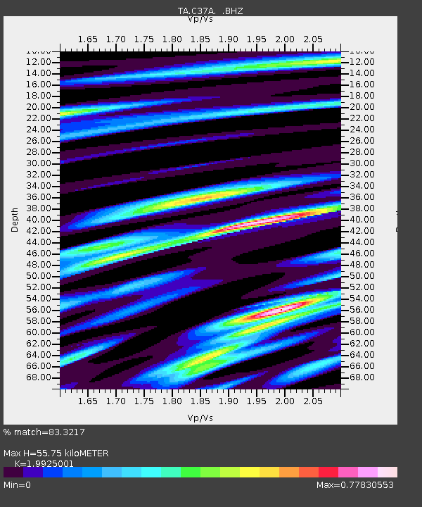
C37A Embarrass, MN, USA - Earthquake Result Viewer
| ||||||||||||||||||
| ||||||||||||||||||
| ||||||||||||||||||
|
Signal To Noise
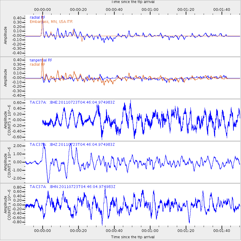
| Channel | StoN | STA | LTA |
| TA:C37A: :BHZ:20110723T04:46:04.974983Z | 14.281994 | 1.460752E-6 | 1.0227927E-7 |
| TA:C37A: :BHN:20110723T04:46:04.974983Z | 2.816025 | 3.2944513E-7 | 1.1698942E-7 |
| TA:C37A: :BHE:20110723T04:46:04.974983Z | 1.7847506 | 3.093786E-7 | 1.7334557E-7 |
| Arrivals | |
| Ps | 8.6 SECOND |
| PpPs | 25 SECOND |
| PsPs/PpSs | 33 SECOND |

