
A33A Warroad, MN, USA - Earthquake Result Viewer
| ||||||||||||||||||
| ||||||||||||||||||
| ||||||||||||||||||
|
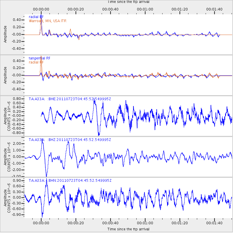
Signal To Noise
| Channel | StoN | STA | LTA |
| TA:A33A: :BHZ:20110723T04:45:52.549995Z | 9.134988 | 1.6263973E-6 | 1.7804047E-7 |
| TA:A33A: :BHN:20110723T04:45:52.549995Z | 3.82413 | 5.250627E-7 | 1.3730254E-7 |
| TA:A33A: :BHE:20110723T04:45:52.549995Z | 3.3255966 | 5.270621E-7 | 1.584865E-7 |
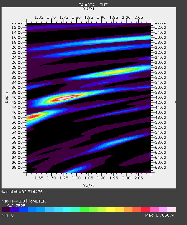
| Arrivals | |
| Ps | 4.8 SECOND |
| PpPs | 17 SECOND |
| PsPs/PpSs | 21 SECOND |

