
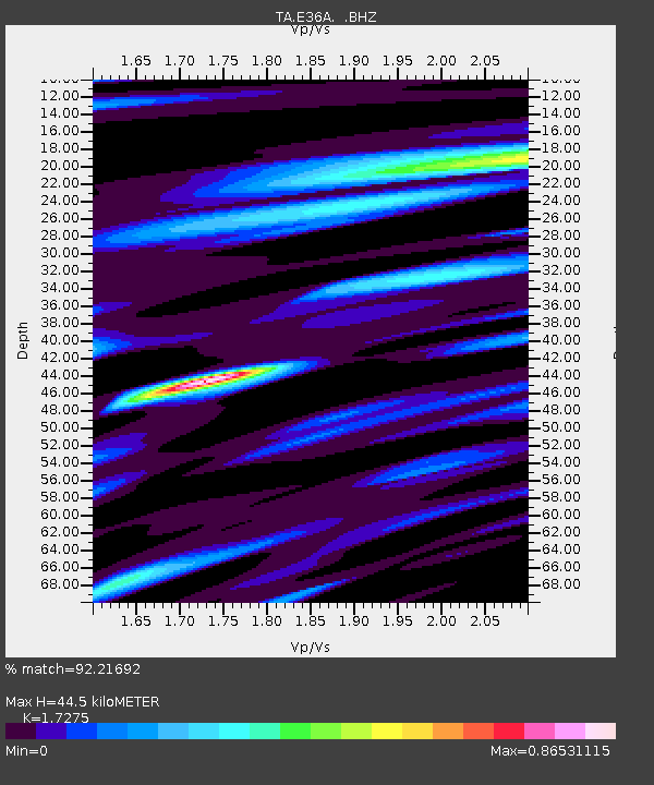
E36A McGregor, MN, USA - Earthquake Result Viewer
| ||||||||||||||||||
| ||||||||||||||||||
| ||||||||||||||||||
|
Signal To Noise
| Channel | StoN | STA | LTA |
| TA:E36A: :BHZ:20110723T04:46:07.399971Z | 8.189853 | 1.5953875E-6 | 1.948005E-7 |
| TA:E36A: :BHN:20110723T04:46:07.399971Z | 3.9060292 | 4.2690002E-7 | 1.0929258E-7 |
| TA:E36A: :BHE:20110723T04:46:07.399971Z | 5.0365014 | 3.545018E-7 | 7.038651E-8 |
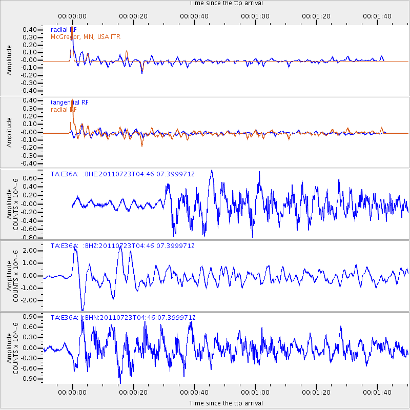
| Arrivals | |
| Ps | 5.1 SECOND |
| PpPs | 18 SECOND |
| PsPs/PpSs | 23 SECOND |

