F32A Veblen, SD, USA - Earthquake Result Viewer
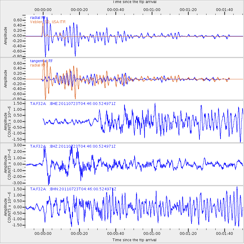
Earthquake location: Near East Coast Of Honshu, Japan
Earthquake latitude/longitude: 38.9/141.8
Earthquake time(UTC): 2011/07/23 (204) 04:34:24 GMT
Earthquake Depth: 41 km
Earthquake Magnitude: 5.9 MB, 5.9 MS, 6.4 MW, 6.3 MW
Earthquake Catalog/Contributor: WHDF/NEIC
Network: TA USArray Transportable Network (new EarthScope stations)
Station: F32A Veblen, SD, USA
Lat/Lon: 45.87 N/97.13 W
Elevation: 371 m
Distance: 80.4 deg
Az: 37.37 deg
Baz: 317.322 deg
Ray Param: 0.048212778
Estimated Moho Depth: 25.0 km
Estimated Crust Vp/Vs: 1.62
Assumed Crust Vp: 6.552 km/s
Estimated Crust Vs: 4.038 km/s
Estimated Crust Poisson's Ratio: 0.19
Radial Match: 83.091255 %
Radial Bump: 400
Transverse Match: 77.34953 %
Transverse Bump: 400
SOD ConfigId: 405110
Insert Time: 2011-12-29 05:10:46.177 +0000
GWidth: 2.5
Max Bumps: 400
Tol: 0.001

Signal To Noise

ChannelStoNSTALTA
TA:F32A: :BHZ:20110723T04:46:00.524971Z16.4982831.554246E-69.420652E-8
TA:F32A: :BHN:20110723T04:46:00.524971Z2.75812845.4000526E-71.9578685E-7
TA:F32A: :BHE:20110723T04:46:00.524971Z4.8161815.348546E-71.1105367E-7
Arrivals
Ps2.5 SECOND
PpPs9.7 SECOND
PsPs/PpSs12 SECOND