You are here: Home > Network List > GS - US Geological Survey Networks Stations List
> Station DEC12 Boyd Road Surface Site > Earthquake Result Viewer
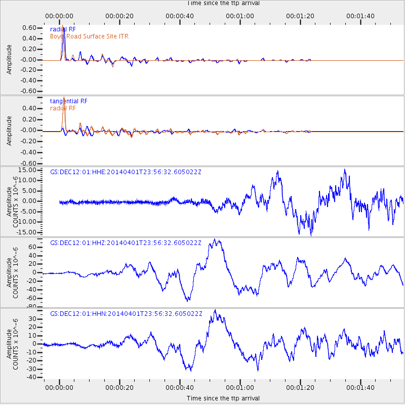
DEC12 Boyd Road Surface Site - Earthquake Result Viewer
*The percent match for this event was below the threshold and hence no stack was calculated.
| Earthquake location: |
Near Coast Of Northern Chile |
| Earthquake latitude/longitude: |
-19.6/-70.8 |
| Earthquake time(UTC): |
2014/04/01 (091) 23:46:46 GMT |
| Earthquake Depth: |
20 km |
| Earthquake Magnitude: |
8.2 MWW, 8.0 MI, 8.1 MWC |
| Earthquake Catalog/Contributor: |
NEIC PDE/NEIC COMCAT |
|
| Network: |
GS US Geological Survey Networks |
| Station: |
DEC12 Boyd Road Surface Site |
| Lat/Lon: |
39.91 N/88.91 W |
| Elevation: |
208 m |
|
| Distance: |
61.6 deg |
| Az: |
344.245 deg |
| Baz: |
160.567 deg |
| Ray Param: |
$rayparam |
*The percent match for this event was below the threshold and hence was not used in the summary stack. |
|
| Radial Match: |
98.09784 % |
| Radial Bump: |
279 |
| Transverse Match: |
79.8479 % |
| Transverse Bump: |
400 |
| SOD ConfigId: |
3390531 |
| Insert Time: |
2019-04-10 23:35:11.945 +0000 |
| GWidth: |
2.5 |
| Max Bumps: |
400 |
| Tol: |
0.001 |
|
Signal To Noise
| Channel | StoN | STA | LTA |
| GS:DEC12:01:HHZ:20140401T23:56:32.605022Z | 7.0797014 | 2.1382873E-6 | 3.020307E-7 |
| GS:DEC12:01:HHN:20140401T23:56:32.605022Z | 1.4658189 | 9.26608E-7 | 6.3214355E-7 |
| GS:DEC12:01:HHE:20140401T23:56:32.605022Z | 1.2883112 | 5.152352E-7 | 3.9993066E-7 |
| Arrivals |
| Ps | |
| PpPs | |
| PsPs/PpSs | |


