
S40A Lebanon, MO, USA - Earthquake Result Viewer
| ||||||||||||||||||
| ||||||||||||||||||
| ||||||||||||||||||
|
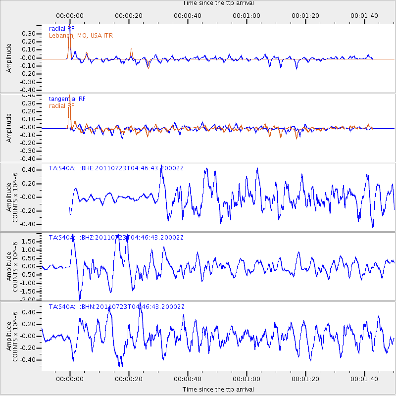
Signal To Noise
| Channel | StoN | STA | LTA |
| TA:S40A: :BHZ:20110723T04:46:43.20002Z | 7.381527 | 1.0649725E-6 | 1.4427536E-7 |
| TA:S40A: :BHN:20110723T04:46:43.20002Z | 1.7581589 | 2.0535576E-7 | 1.1680159E-7 |
| TA:S40A: :BHE:20110723T04:46:43.20002Z | 3.8773699 | 2.3065955E-7 | 5.9488666E-8 |
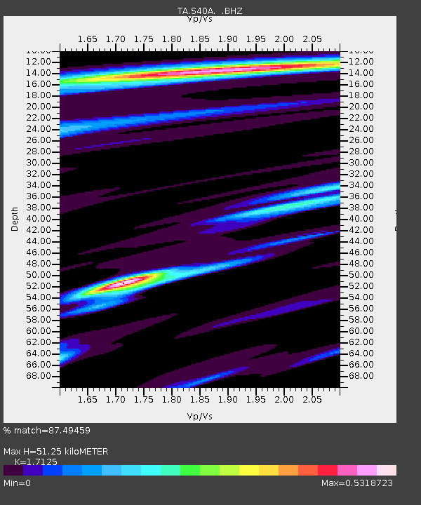
| Arrivals | |
| Ps | 5.7 SECOND |
| PpPs | 21 SECOND |
| PsPs/PpSs | 27 SECOND |

