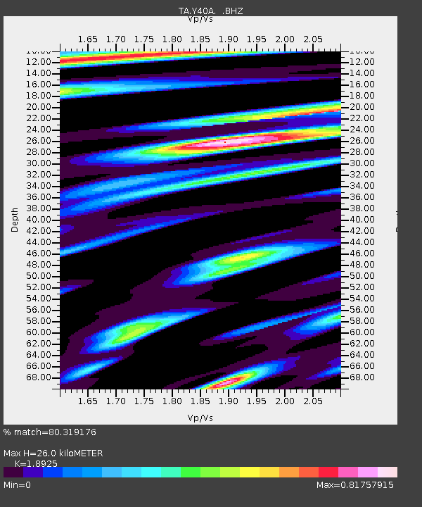
Y40A Okolona, AR, USA - Earthquake Result Viewer
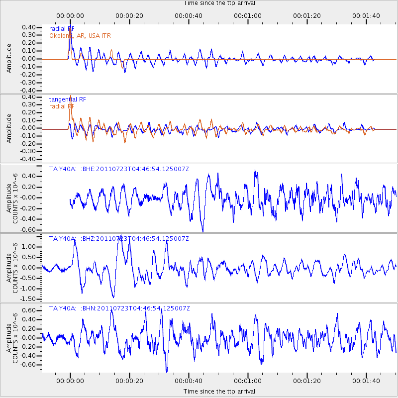
Earthquake location: Near East Coast Of Honshu, Japan
Earthquake latitude/longitude: 38.9/141.8
Earthquake time(UTC): 2011/07/23 (204) 04:34:24 GMT
Earthquake Depth: 41 km
Earthquake Magnitude: 5.9 MB, 5.9 MS, 6.4 MW, 6.3 MW
Earthquake Catalog/Contributor: WHDF/NEIC
Network: TA USArray Transportable Network (new EarthScope stations)
Station: Y40A Okolona, AR, USA
Lat/Lon: 34.01 N/93.28 W
Elevation: 117 m
Distance: 91.3 deg
Az: 42.953 deg
Baz: 320.2 deg
Ray Param: 0.041606154
Estimated Moho Depth: 26.0 km
Estimated Crust Vp/Vs: 1.89
Assumed Crust Vp: 6.498 km/s
Estimated Crust Vs: 3.433 km/s
Estimated Crust Poisson's Ratio: 0.31
Radial Match: 80.319176 %
Radial Bump: 400
Transverse Match: 63.746094 %
Transverse Bump: 400
SOD ConfigId: 405110
Insert Time: 2011-12-29 05:14:08.088 +0000
GWidth: 2.5
Max Bumps: 400
Tol: 0.001

Signal To Noise

ChannelStoNSTALTA
TA:Y40A: :BHZ:20110723T04:46:54.125007Z8.14310557.1140073E-78.736234E-8
TA:Y40A: :BHN:20110723T04:46:54.125007Z2.51950362.3129773E-79.18029E-8
TA:Y40A: :BHE:20110723T04:46:54.125007Z1.19240141.606483E-71.3472669E-7
Arrivals
Ps3.6 SECOND
PpPs11 SECOND
PsPs/PpSs15 SECOND