T38A Diamond, MO, USA - Earthquake Result Viewer
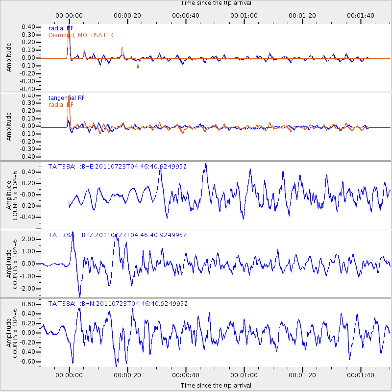
Earthquake location: Near East Coast Of Honshu, Japan
Earthquake latitude/longitude: 38.9/141.8
Earthquake time(UTC): 2011/07/23 (204) 04:34:24 GMT
Earthquake Depth: 41 km
Earthquake Magnitude: 5.9 MB, 5.9 MS, 6.4 MW, 6.3 MW
Earthquake Catalog/Contributor: WHDF/NEIC
Network: TA USArray Transportable Network (new EarthScope stations)
Station: T38A Diamond, MO, USA
Lat/Lon: 37.04 N/94.29 W
Elevation: 349 m
Distance: 88.5 deg
Az: 41.642 deg
Baz: 319.611 deg
Ray Param: 0.042508956
Estimated Moho Depth: 20.0 km
Estimated Crust Vp/Vs: 1.80
Assumed Crust Vp: 6.53 km/s
Estimated Crust Vs: 3.633 km/s
Estimated Crust Poisson's Ratio: 0.28
Radial Match: 87.04991 %
Radial Bump: 377
Transverse Match: 71.7198 %
Transverse Bump: 400
SOD ConfigId: 405110
Insert Time: 2011-12-29 05:14:20.463 +0000
GWidth: 2.5
Max Bumps: 400
Tol: 0.001

Signal To Noise

ChannelStoNSTALTA
TA:T38A: :BHZ:20110723T04:46:40.924995Z7.91820761.3520994E-61.7075826E-7
TA:T38A: :BHN:20110723T04:46:40.924995Z3.6676253.1439308E-78.572117E-8
TA:T38A: :BHE:20110723T04:46:40.924995Z2.79711172.5684636E-79.1825555E-8
Arrivals
Ps2.5 SECOND
PpPs8.4 SECOND
PsPs/PpSs11 SECOND