V39A Pettigrew, AR, USA - Earthquake Result Viewer
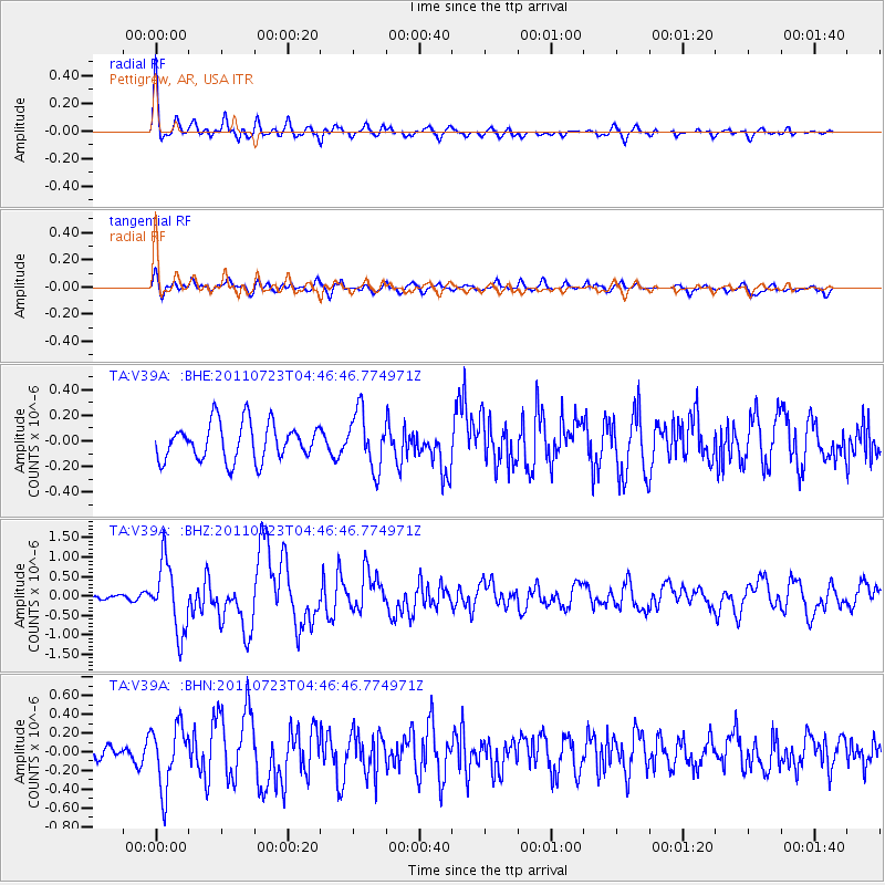
Earthquake location: Near East Coast Of Honshu, Japan
Earthquake latitude/longitude: 38.9/141.8
Earthquake time(UTC): 2011/07/23 (204) 04:34:24 GMT
Earthquake Depth: 41 km
Earthquake Magnitude: 5.9 MB, 5.9 MS, 6.4 MW, 6.3 MW
Earthquake Catalog/Contributor: WHDF/NEIC
Network: TA USArray Transportable Network (new EarthScope stations)
Station: V39A Pettigrew, AR, USA
Lat/Lon: 35.84 N/93.64 W
Elevation: 744 m
Distance: 89.7 deg
Az: 42.014 deg
Baz: 320.0 deg
Ray Param: 0.04171958
Estimated Moho Depth: 24.5 km
Estimated Crust Vp/Vs: 1.88
Assumed Crust Vp: 6.498 km/s
Estimated Crust Vs: 3.452 km/s
Estimated Crust Poisson's Ratio: 0.30
Radial Match: 85.659386 %
Radial Bump: 400
Transverse Match: 69.95189 %
Transverse Bump: 400
SOD ConfigId: 405110
Insert Time: 2011-12-29 05:14:46.377 +0000
GWidth: 2.5
Max Bumps: 400
Tol: 0.001

Signal To Noise

ChannelStoNSTALTA
TA:V39A: :BHZ:20110723T04:46:46.774971Z7.68656258.832218E-71.1490465E-7
TA:V39A: :BHN:20110723T04:46:46.774971Z4.28563173.3186438E-77.743652E-8
TA:V39A: :BHE:20110723T04:46:46.774971Z1.51595392.1800469E-71.4380693E-7
Arrivals
Ps3.4 SECOND
PpPs11 SECOND
PsPs/PpSs14 SECOND