You are here: Home > Network List > TA - USArray Transportable Network (new EarthScope stations) Stations List
> Station Y43A Makayla and Karen, Gunnison, MS, USA > Earthquake Result Viewer
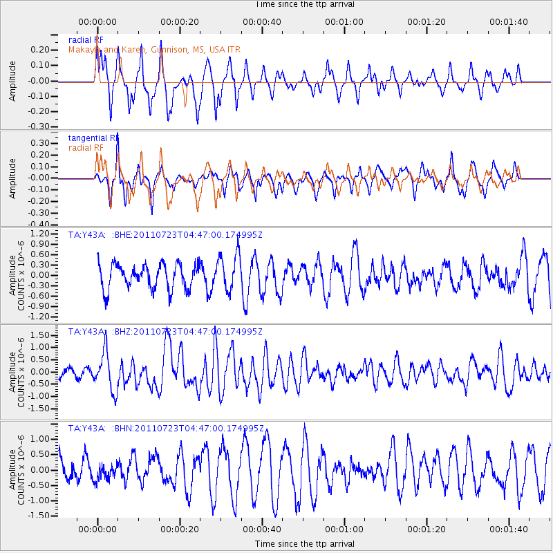
Y43A Makayla and Karen, Gunnison, MS, USA - Earthquake Result Viewer
*The percent match for this event was below the threshold and hence no stack was calculated.
| Earthquake location: |
Near East Coast Of Honshu, Japan |
| Earthquake latitude/longitude: |
38.9/141.8 |
| Earthquake time(UTC): |
2011/07/23 (204) 04:34:24 GMT |
| Earthquake Depth: |
41 km |
| Earthquake Magnitude: |
5.9 MB, 5.9 MS, 6.4 MW, 6.3 MW |
| Earthquake Catalog/Contributor: |
WHDF/NEIC |
|
| Network: |
TA USArray Transportable Network (new EarthScope stations) |
| Station: |
Y43A Makayla and Karen, Gunnison, MS, USA |
| Lat/Lon: |
33.91 N/90.93 W |
| Elevation: |
46 m |
|
| Distance: |
92.6 deg |
| Az: |
41.499 deg |
| Baz: |
321.558 deg |
| Ray Param: |
$rayparam |
*The percent match for this event was below the threshold and hence was not used in the summary stack. |
|
| Radial Match: |
68.01392 % |
| Radial Bump: |
353 |
| Transverse Match: |
56.248066 % |
| Transverse Bump: |
329 |
| SOD ConfigId: |
405110 |
| Insert Time: |
2011-12-29 05:18:16.360 +0000 |
| GWidth: |
2.5 |
| Max Bumps: |
400 |
| Tol: |
0.001 |
|
Signal To Noise
| Channel | StoN | STA | LTA |
| TA:Y43A: :BHZ:20110723T04:47:00.174995Z | 3.9318411 | 8.0836423E-7 | 2.0559433E-7 |
| TA:Y43A: :BHN:20110723T04:47:00.174995Z | 0.3839549 | 2.467473E-7 | 6.4264657E-7 |
| TA:Y43A: :BHE:20110723T04:47:00.174995Z | 1.5126009 | 5.3352755E-7 | 3.5272197E-7 |
| Arrivals |
| Ps | |
| PpPs | |
| PsPs/PpSs | |


