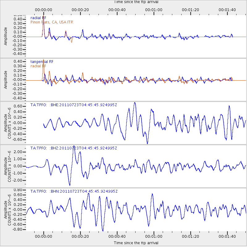
TPFO Pinon Flats, CA, USA - Earthquake Result Viewer
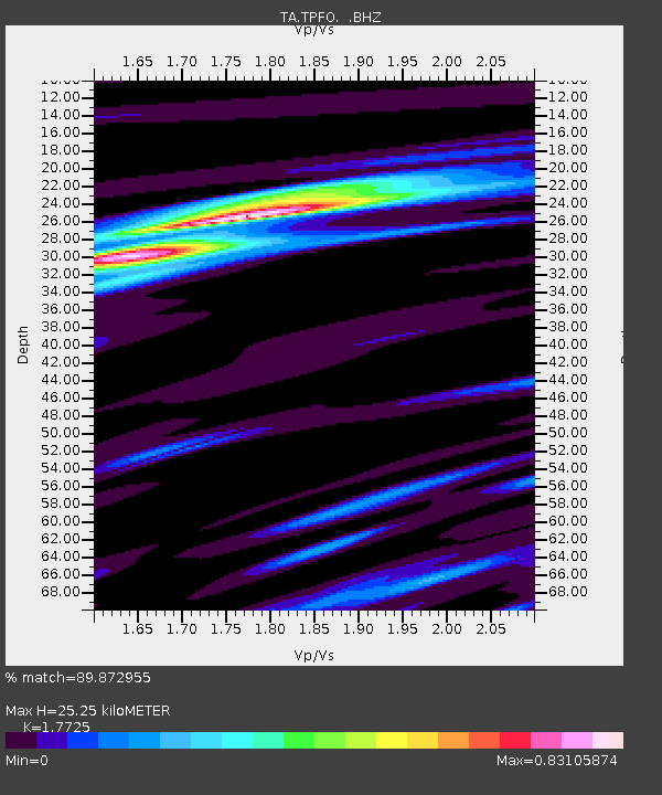
Earthquake location: Near East Coast Of Honshu, Japan
Earthquake latitude/longitude: 38.9/141.8
Earthquake time(UTC): 2011/07/23 (204) 04:34:24 GMT
Earthquake Depth: 41 km
Earthquake Magnitude: 5.9 MB, 5.9 MS, 6.4 MW, 6.3 MW
Earthquake Catalog/Contributor: WHDF/NEIC
Network: TA USArray Transportable Network (new EarthScope stations)
Station: TPFO Pinon Flats, CA, USA
Lat/Lon: 33.61 N/116.45 W
Elevation: 1275 m
Distance: 77.8 deg
Az: 56.738 deg
Baz: 308.573 deg
Ray Param: 0.0500409
Estimated Moho Depth: 25.25 km
Estimated Crust Vp/Vs: 1.77
Assumed Crust Vp: 6.264 km/s
Estimated Crust Vs: 3.534 km/s
Estimated Crust Poisson's Ratio: 0.27
Radial Match: 89.872955 %
Radial Bump: 367
Transverse Match: 77.73852 %
Transverse Bump: 374
SOD ConfigId: 405110
Insert Time: 2011-12-29 05:19:33.895 +0000
GWidth: 2.5
Max Bumps: 400
Tol: 0.001

Signal To Noise

ChannelStoNSTALTA
TA:TPFO: :BHZ:20110723T04:45:45.924995Z6.4961146.452312E-79.9325725E-8
TA:TPFO: :BHN:20110723T04:45:45.924995Z2.37725521.9868624E-78.3577994E-8
TA:TPFO: :BHE:20110723T04:45:45.924995Z1.78278651.7851492E-71.0013253E-7
Arrivals
Ps3.2 SECOND
PpPs11 SECOND
PsPs/PpSs14 SECOND