You are here: Home > Network List > TA - USArray Transportable Network (new EarthScope stations) Stations List
> Station X44A Crenshaw, MS, USA > Earthquake Result Viewer
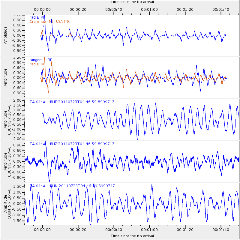
X44A Crenshaw, MS, USA - Earthquake Result Viewer
*The percent match for this event was below the threshold and hence no stack was calculated.
| Earthquake location: |
Near East Coast Of Honshu, Japan |
| Earthquake latitude/longitude: |
38.9/141.8 |
| Earthquake time(UTC): |
2011/07/23 (204) 04:34:24 GMT |
| Earthquake Depth: |
41 km |
| Earthquake Magnitude: |
5.9 MB, 5.9 MS, 6.4 MW, 6.3 MW |
| Earthquake Catalog/Contributor: |
WHDF/NEIC |
|
| Network: |
TA USArray Transportable Network (new EarthScope stations) |
| Station: |
X44A Crenshaw, MS, USA |
| Lat/Lon: |
34.50 N/90.15 W |
| Elevation: |
109 m |
|
| Distance: |
92.6 deg |
| Az: |
40.626 deg |
| Baz: |
322.035 deg |
| Ray Param: |
$rayparam |
*The percent match for this event was below the threshold and hence was not used in the summary stack. |
|
| Radial Match: |
60.456573 % |
| Radial Bump: |
292 |
| Transverse Match: |
59.009678 % |
| Transverse Bump: |
332 |
| SOD ConfigId: |
405110 |
| Insert Time: |
2011-12-29 05:19:50.645 +0000 |
| GWidth: |
2.5 |
| Max Bumps: |
400 |
| Tol: |
0.001 |
|
Signal To Noise
| Channel | StoN | STA | LTA |
| TA:X44A: :BHZ:20110723T04:46:59.899971Z | 6.127952 | 5.8483533E-7 | 9.543733E-8 |
| TA:X44A: :BHN:20110723T04:46:59.899971Z | 0.905885 | 6.0555794E-7 | 6.684711E-7 |
| TA:X44A: :BHE:20110723T04:46:59.899971Z | 0.76918495 | 4.104555E-7 | 5.3362396E-7 |
| Arrivals |
| Ps | |
| PpPs | |
| PsPs/PpSs | |


