V41A Mountainview, AR, USA - Earthquake Result Viewer
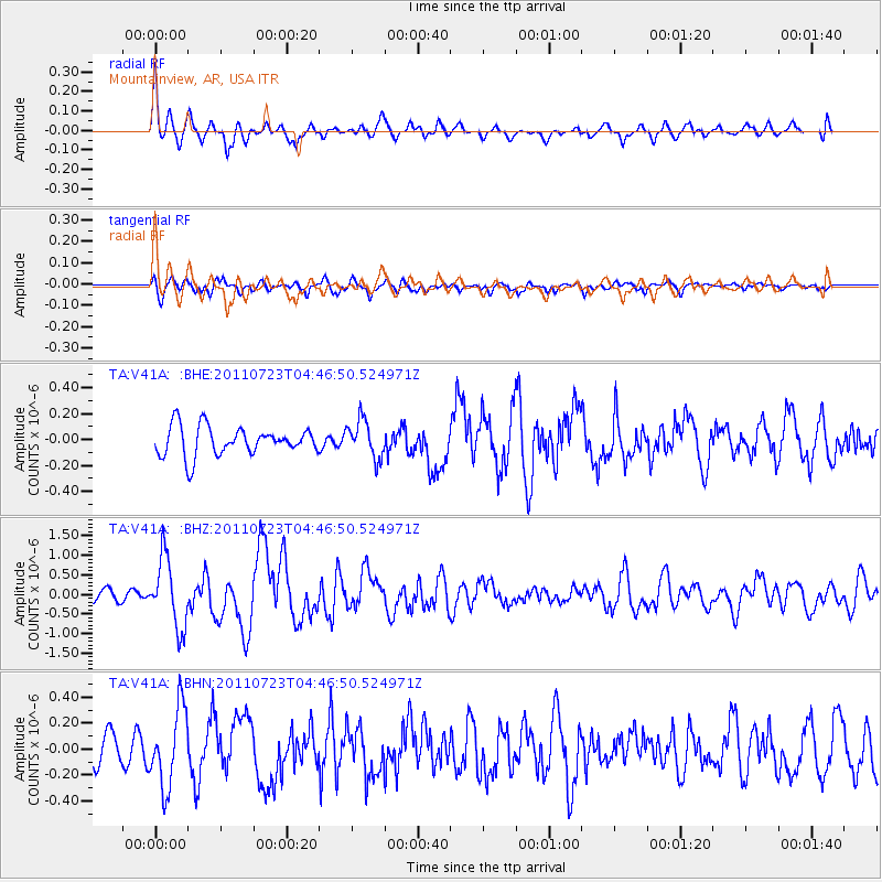
Earthquake location: Near East Coast Of Honshu, Japan
Earthquake latitude/longitude: 38.9/141.8
Earthquake time(UTC): 2011/07/23 (204) 04:34:24 GMT
Earthquake Depth: 41 km
Earthquake Magnitude: 5.9 MB, 5.9 MS, 6.4 MW, 6.3 MW
Earthquake Catalog/Contributor: WHDF/NEIC
Network: TA USArray Transportable Network (new EarthScope stations)
Station: V41A Mountainview, AR, USA
Lat/Lon: 35.79 N/92.16 W
Elevation: 413 m
Distance: 90.5 deg
Az: 41.115 deg
Baz: 320.87 deg
Ray Param: 0.04166163
Estimated Moho Depth: 11.25 km
Estimated Crust Vp/Vs: 2.10
Assumed Crust Vp: 6.498 km/s
Estimated Crust Vs: 3.098 km/s
Estimated Crust Poisson's Ratio: 0.35
Radial Match: 81.05529 %
Radial Bump: 400
Transverse Match: 56.531155 %
Transverse Bump: 400
SOD ConfigId: 405110
Insert Time: 2011-12-29 05:20:18.289 +0000
GWidth: 2.5
Max Bumps: 400
Tol: 0.001

Signal To Noise

ChannelStoNSTALTA
TA:V41A: :BHZ:20110723T04:46:50.524971Z5.12690268.7978907E-71.7160247E-7
TA:V41A: :BHN:20110723T04:46:50.524971Z2.3180323.0106085E-71.2987778E-7
TA:V41A: :BHE:20110723T04:46:50.524971Z1.31261361.4672118E-71.11777894E-7
Arrivals
Ps1.9 SECOND
PpPs5.3 SECOND
PsPs/PpSs7.2 SECOND