S44A Carbondale, IL, USA - Earthquake Result Viewer
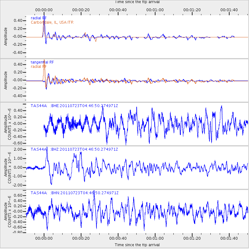
Earthquake location: Near East Coast Of Honshu, Japan
Earthquake latitude/longitude: 38.9/141.8
Earthquake time(UTC): 2011/07/23 (204) 04:34:24 GMT
Earthquake Depth: 41 km
Earthquake Magnitude: 5.9 MB, 5.9 MS, 6.4 MW, 6.3 MW
Earthquake Catalog/Contributor: WHDF/NEIC
Network: TA USArray Transportable Network (new EarthScope stations)
Station: S44A Carbondale, IL, USA
Lat/Lon: 37.69 N/89.26 W
Elevation: 155 m
Distance: 90.5 deg
Az: 38.106 deg
Baz: 322.624 deg
Ray Param: 0.041665412
Estimated Moho Depth: 41.5 km
Estimated Crust Vp/Vs: 1.96
Assumed Crust Vp: 6.444 km/s
Estimated Crust Vs: 3.292 km/s
Estimated Crust Poisson's Ratio: 0.32
Radial Match: 89.296104 %
Radial Bump: 400
Transverse Match: 71.82952 %
Transverse Bump: 400
SOD ConfigId: 405110
Insert Time: 2011-12-29 05:21:10.809 +0000
GWidth: 2.5
Max Bumps: 400
Tol: 0.001

Signal To Noise

ChannelStoNSTALTA
TA:S44A: :BHZ:20110723T04:46:50.274971Z9.4517211.0160974E-61.0750395E-7
TA:S44A: :BHN:20110723T04:46:50.274971Z2.452522.7493442E-71.1210283E-7
TA:S44A: :BHE:20110723T04:46:50.274971Z1.92408482.7861228E-71.448025E-7
Arrivals
Ps6.3 SECOND
PpPs19 SECOND
PsPs/PpSs25 SECOND