You are here: Home > Network List > TA - USArray Transportable Network (new EarthScope stations) Stations List
> Station Q43A New Douglas, IL, USA > Earthquake Result Viewer
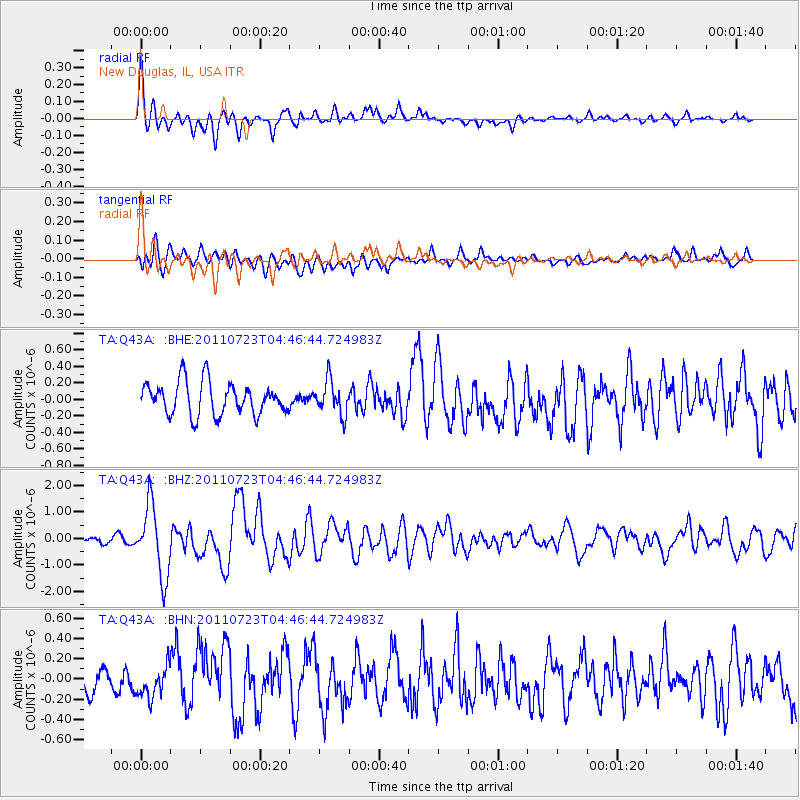
Q43A New Douglas, IL, USA - Earthquake Result Viewer
*The percent match for this event was below the threshold and hence no stack was calculated.
| Earthquake location: |
Near East Coast Of Honshu, Japan |
| Earthquake latitude/longitude: |
38.9/141.8 |
| Earthquake time(UTC): |
2011/07/23 (204) 04:34:24 GMT |
| Earthquake Depth: |
41 km |
| Earthquake Magnitude: |
5.9 MB, 5.9 MS, 6.4 MW, 6.3 MW |
| Earthquake Catalog/Contributor: |
WHDF/NEIC |
|
| Network: |
TA USArray Transportable Network (new EarthScope stations) |
| Station: |
Q43A New Douglas, IL, USA |
| Lat/Lon: |
38.94 N/89.70 W |
| Elevation: |
202 m |
|
| Distance: |
89.3 deg |
| Az: |
37.625 deg |
| Baz: |
322.349 deg |
| Ray Param: |
$rayparam |
*The percent match for this event was below the threshold and hence was not used in the summary stack. |
|
| Radial Match: |
78.3354 % |
| Radial Bump: |
400 |
| Transverse Match: |
65.88371 % |
| Transverse Bump: |
400 |
| SOD ConfigId: |
405110 |
| Insert Time: |
2011-12-29 05:21:20.169 +0000 |
| GWidth: |
2.5 |
| Max Bumps: |
400 |
| Tol: |
0.001 |
|
Signal To Noise
| Channel | StoN | STA | LTA |
| TA:Q43A: :BHZ:20110723T04:46:44.724983Z | 9.850079 | 1.3233268E-6 | 1.3434682E-7 |
| TA:Q43A: :BHN:20110723T04:46:44.724983Z | 1.4031197 | 1.5089543E-7 | 1.075428E-7 |
| TA:Q43A: :BHE:20110723T04:46:44.724983Z | 1.0315667 | 2.0179183E-7 | 1.9561685E-7 |
| Arrivals |
| Ps | |
| PpPs | |
| PsPs/PpSs | |


