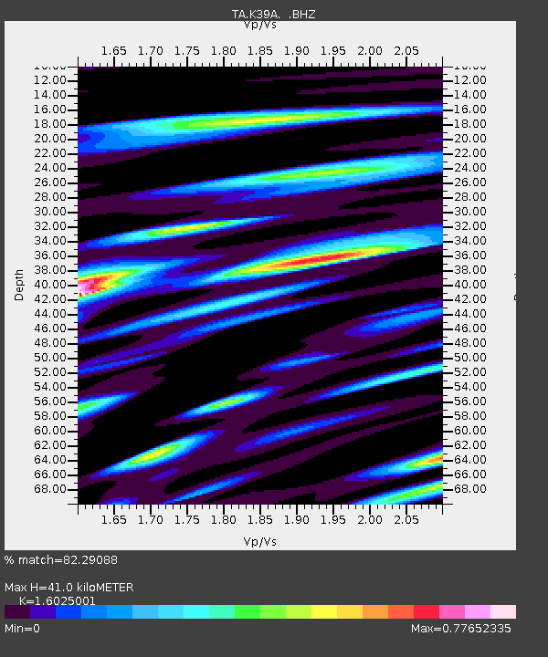
K39A Oelwein, IA, USA - Earthquake Result Viewer
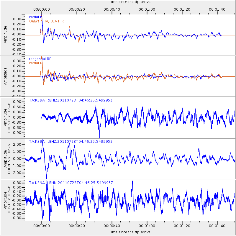
Earthquake location: Near East Coast Of Honshu, Japan
Earthquake latitude/longitude: 38.9/141.8
Earthquake time(UTC): 2011/07/23 (204) 04:34:24 GMT
Earthquake Depth: 41 km
Earthquake Magnitude: 5.9 MB, 5.9 MS, 6.4 MW, 6.3 MW
Earthquake Catalog/Contributor: WHDF/NEIC
Network: TA USArray Transportable Network (new EarthScope stations)
Station: K39A Oelwein, IA, USA
Lat/Lon: 42.71 N/91.89 W
Elevation: 332 m
Distance: 85.3 deg
Az: 36.591 deg
Baz: 320.873 deg
Ray Param: 0.044808023
Estimated Moho Depth: 41.0 km
Estimated Crust Vp/Vs: 1.60
Assumed Crust Vp: 6.53 km/s
Estimated Crust Vs: 4.075 km/s
Estimated Crust Poisson's Ratio: 0.18
Radial Match: 82.29088 %
Radial Bump: 400
Transverse Match: 65.20175 %
Transverse Bump: 400
SOD ConfigId: 405110
Insert Time: 2011-12-29 05:21:49.976 +0000
GWidth: 2.5
Max Bumps: 400
Tol: 0.001

Signal To Noise

ChannelStoNSTALTA
TA:K39A: :BHZ:20110723T04:46:25.549995Z11.8008781.3695843E-61.1605784E-7
TA:K39A: :BHN:20110723T04:46:25.549995Z4.9557214.4481894E-78.975867E-8
TA:K39A: :BHE:20110723T04:46:25.549995Z3.28636744.3045034E-71.309806E-7
Arrivals
Ps3.9 SECOND
PpPs16 SECOND
PsPs/PpSs20 SECOND