L39A Vinton, IA, USA - Earthquake Result Viewer
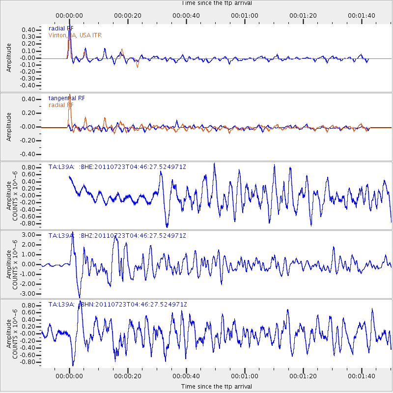
Earthquake location: Near East Coast Of Honshu, Japan
Earthquake latitude/longitude: 38.9/141.8
Earthquake time(UTC): 2011/07/23 (204) 04:34:24 GMT
Earthquake Depth: 41 km
Earthquake Magnitude: 5.9 MB, 5.9 MS, 6.4 MW, 6.3 MW
Earthquake Catalog/Contributor: WHDF/NEIC
Network: TA USArray Transportable Network (new EarthScope stations)
Station: L39A Vinton, IA, USA
Lat/Lon: 42.12 N/92.00 W
Elevation: 261 m
Distance: 85.7 deg
Az: 37.024 deg
Baz: 320.832 deg
Ray Param: 0.044523068
Estimated Moho Depth: 41.25 km
Estimated Crust Vp/Vs: 1.87
Assumed Crust Vp: 6.53 km/s
Estimated Crust Vs: 3.492 km/s
Estimated Crust Poisson's Ratio: 0.30
Radial Match: 87.3578 %
Radial Bump: 338
Transverse Match: 73.92558 %
Transverse Bump: 400
SOD ConfigId: 405110
Insert Time: 2011-12-29 05:22:01.825 +0000
GWidth: 2.5
Max Bumps: 400
Tol: 0.001

Signal To Noise

ChannelStoNSTALTA
TA:L39A: :BHZ:20110723T04:46:27.524971Z13.87494851.7583999E-61.2673199E-7
TA:L39A: :BHN:20110723T04:46:27.524971Z3.250785.3453005E-71.6443133E-7
TA:L39A: :BHE:20110723T04:46:27.524971Z2.7263964.6535226E-71.7068402E-7
Arrivals
Ps5.6 SECOND
PpPs18 SECOND
PsPs/PpSs23 SECOND