L40A Anamosa, IA, USA - Earthquake Result Viewer
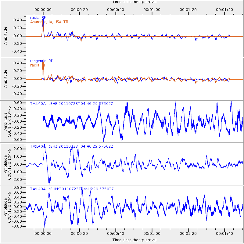
Earthquake location: Near East Coast Of Honshu, Japan
Earthquake latitude/longitude: 38.9/141.8
Earthquake time(UTC): 2011/07/23 (204) 04:34:24 GMT
Earthquake Depth: 41 km
Earthquake Magnitude: 5.9 MB, 5.9 MS, 6.4 MW, 6.3 MW
Earthquake Catalog/Contributor: WHDF/NEIC
Network: TA USArray Transportable Network (new EarthScope stations)
Station: L40A Anamosa, IA, USA
Lat/Lon: 42.06 N/91.22 W
Elevation: 242 m
Distance: 86.1 deg
Az: 36.61 deg
Baz: 321.322 deg
Ray Param: 0.044231407
Estimated Moho Depth: 39.0 km
Estimated Crust Vp/Vs: 1.74
Assumed Crust Vp: 6.53 km/s
Estimated Crust Vs: 3.748 km/s
Estimated Crust Poisson's Ratio: 0.25
Radial Match: 89.956955 %
Radial Bump: 377
Transverse Match: 81.46738 %
Transverse Bump: 400
SOD ConfigId: 405110
Insert Time: 2011-12-29 05:22:40.491 +0000
GWidth: 2.5
Max Bumps: 400
Tol: 0.001

Signal To Noise

ChannelStoNSTALTA
TA:L40A: :BHZ:20110723T04:46:29.57502Z12.9259371.4394861E-61.11364166E-7
TA:L40A: :BHN:20110723T04:46:29.57502Z2.9623933.9321685E-71.3273622E-7
TA:L40A: :BHE:20110723T04:46:29.57502Z3.029993.308111E-71.0917895E-7
Arrivals
Ps4.5 SECOND
PpPs16 SECOND
PsPs/PpSs21 SECOND