You are here: Home > Network List > TA - USArray Transportable Network (new EarthScope stations) Stations List
> Station U41A Viola, AR, USA > Earthquake Result Viewer
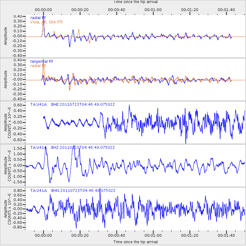
U41A Viola, AR, USA - Earthquake Result Viewer
*The percent match for this event was below the threshold and hence no stack was calculated.
| Earthquake location: |
Near East Coast Of Honshu, Japan |
| Earthquake latitude/longitude: |
38.9/141.8 |
| Earthquake time(UTC): |
2011/07/23 (204) 04:34:24 GMT |
| Earthquake Depth: |
41 km |
| Earthquake Magnitude: |
5.9 MB, 5.9 MS, 6.4 MW, 6.3 MW |
| Earthquake Catalog/Contributor: |
WHDF/NEIC |
|
| Network: |
TA USArray Transportable Network (new EarthScope stations) |
| Station: |
U41A Viola, AR, USA |
| Lat/Lon: |
36.34 N/91.92 W |
| Elevation: |
300 m |
|
| Distance: |
90.2 deg |
| Az: |
40.615 deg |
| Baz: |
321.011 deg |
| Ray Param: |
$rayparam |
*The percent match for this event was below the threshold and hence was not used in the summary stack. |
|
| Radial Match: |
76.77298 % |
| Radial Bump: |
400 |
| Transverse Match: |
66.088974 % |
| Transverse Bump: |
400 |
| SOD ConfigId: |
405110 |
| Insert Time: |
2011-12-29 05:23:03.524 +0000 |
| GWidth: |
2.5 |
| Max Bumps: |
400 |
| Tol: |
0.001 |
|
Signal To Noise
| Channel | StoN | STA | LTA |
| TA:U41A: :BHZ:20110723T04:46:49.07502Z | 6.5500045 | 9.231803E-7 | 1.4094346E-7 |
| TA:U41A: :BHN:20110723T04:46:49.07502Z | 2.8060074 | 3.0174112E-7 | 1.0753398E-7 |
| TA:U41A: :BHE:20110723T04:46:49.07502Z | 2.6620727 | 2.249468E-7 | 8.450063E-8 |
| Arrivals |
| Ps | |
| PpPs | |
| PsPs/PpSs | |


