LTY Liberty (broad-band) - Earthquake Result Viewer
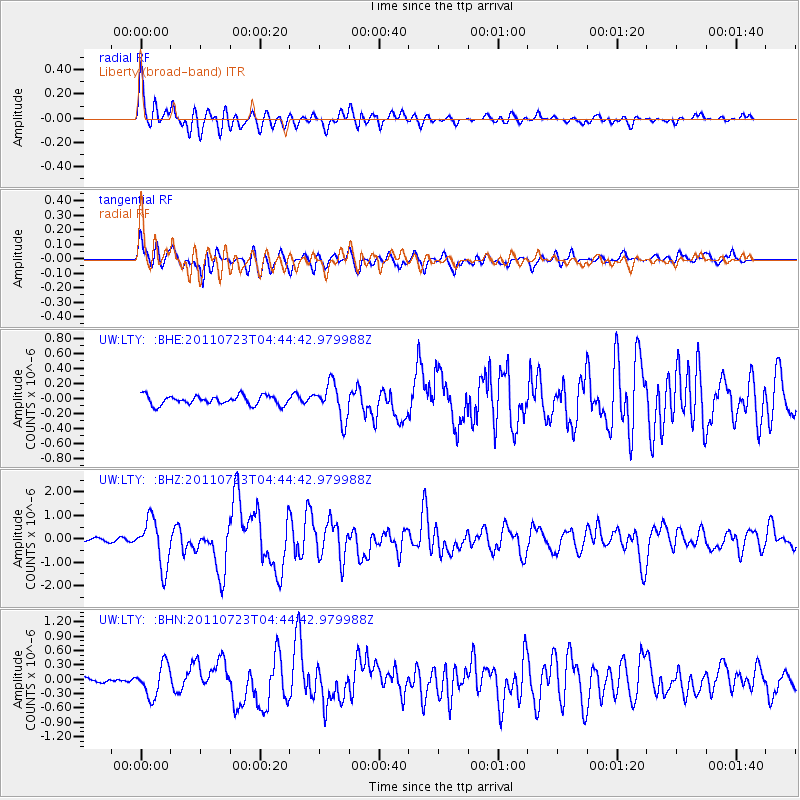
Earthquake location: Near East Coast Of Honshu, Japan
Earthquake latitude/longitude: 38.9/141.8
Earthquake time(UTC): 2011/07/23 (204) 04:34:24 GMT
Earthquake Depth: 41 km
Earthquake Magnitude: 5.9 MB, 5.9 MS, 6.4 MW, 6.3 MW
Earthquake Catalog/Contributor: WHDF/NEIC
Network: UW Pacific Northwest Regional Seismic Network
Station: LTY Liberty (broad-band)
Lat/Lon: 47.26 N/120.66 W
Elevation: 970 m
Distance: 67.2 deg
Az: 47.123 deg
Baz: 302.915 deg
Ray Param: 0.057068184
Estimated Moho Depth: 48.0 km
Estimated Crust Vp/Vs: 1.71
Assumed Crust Vp: 6.597 km/s
Estimated Crust Vs: 3.864 km/s
Estimated Crust Poisson's Ratio: 0.24
Radial Match: 87.96201 %
Radial Bump: 400
Transverse Match: 87.179985 %
Transverse Bump: 400
SOD ConfigId: 405110
Insert Time: 2011-12-29 05:23:54.236 +0000
GWidth: 2.5
Max Bumps: 400
Tol: 0.001

Signal To Noise

ChannelStoNSTALTA
UW:LTY: :BHZ:20110723T04:44:42.979988Z9.254411.0005213E-61.08112914E-7
UW:LTY: :BHN:20110723T04:44:42.979988Z5.4344413.2740758E-76.024678E-8
UW:LTY: :BHE:20110723T04:44:42.979988Z3.78096682.3328782E-76.1700575E-8
Arrivals
Ps5.4 SECOND
PpPs19 SECOND
PsPs/PpSs24 SECOND