YACT Amboy, WA, USA - Earthquake Result Viewer
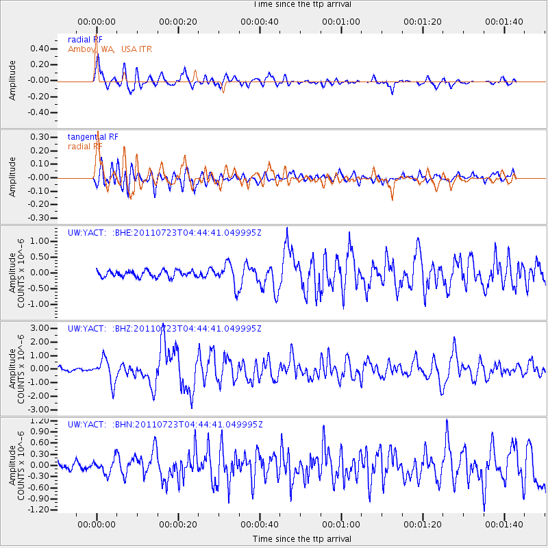
Earthquake location: Near East Coast Of Honshu, Japan
Earthquake latitude/longitude: 38.9/141.8
Earthquake time(UTC): 2011/07/23 (204) 04:34:24 GMT
Earthquake Depth: 41 km
Earthquake Magnitude: 5.9 MB, 5.9 MS, 6.4 MW, 6.3 MW
Earthquake Catalog/Contributor: WHDF/NEIC
Network: UW Pacific Northwest Regional Seismic Network
Station: YACT Amboy, WA, USA
Lat/Lon: 45.93 N/122.42 W
Elevation: 211 m
Distance: 66.8 deg
Az: 49.043 deg
Baz: 302.395 deg
Ray Param: 0.05726743
Estimated Moho Depth: 18.25 km
Estimated Crust Vp/Vs: 1.60
Assumed Crust Vp: 6.566 km/s
Estimated Crust Vs: 4.104 km/s
Estimated Crust Poisson's Ratio: 0.18
Radial Match: 88.77932 %
Radial Bump: 400
Transverse Match: 76.17941 %
Transverse Bump: 400
SOD ConfigId: 405110
Insert Time: 2011-12-29 05:24:33.779 +0000
GWidth: 2.5
Max Bumps: 400
Tol: 0.001

Signal To Noise

ChannelStoNSTALTA
UW:YACT: :BHZ:20110723T04:44:41.049995Z7.7914589.013062E-71.1567876E-7
UW:YACT: :BHN:20110723T04:44:41.049995Z1.96338831.9172049E-79.764777E-8
UW:YACT: :BHE:20110723T04:44:41.049995Z3.62777573.6496317E-71.0060246E-7
Arrivals
Ps1.7 SECOND
PpPs6.9 SECOND
PsPs/PpSs8.6 SECOND