STOR Enumclaw, WA, USA - Earthquake Result Viewer
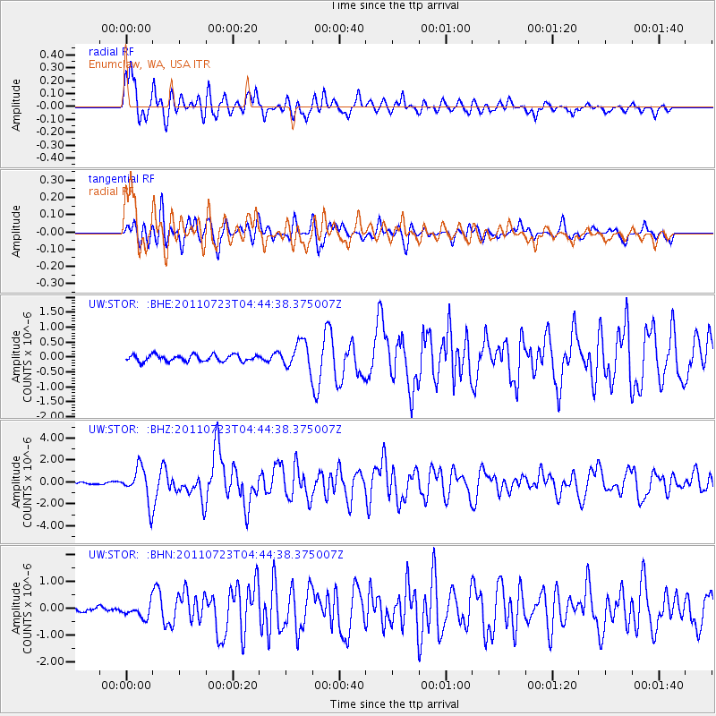
Earthquake location: Near East Coast Of Honshu, Japan
Earthquake latitude/longitude: 38.9/141.8
Earthquake time(UTC): 2011/07/23 (204) 04:34:24 GMT
Earthquake Depth: 41 km
Earthquake Magnitude: 5.9 MB, 5.9 MS, 6.4 MW, 6.3 MW
Earthquake Catalog/Contributor: WHDF/NEIC
Network: UW Pacific Northwest Regional Seismic Network
Station: STOR Enumclaw, WA, USA
Lat/Lon: 47.19 N/121.99 W
Elevation: 266 m
Distance: 66.4 deg
Az: 47.714 deg
Baz: 302.179 deg
Ray Param: 0.05754682
Estimated Moho Depth: 16.5 km
Estimated Crust Vp/Vs: 1.60
Assumed Crust Vp: 6.597 km/s
Estimated Crust Vs: 4.123 km/s
Estimated Crust Poisson's Ratio: 0.18
Radial Match: 91.9898 %
Radial Bump: 400
Transverse Match: 76.94744 %
Transverse Bump: 400
SOD ConfigId: 405110
Insert Time: 2011-12-29 05:24:58.633 +0000
GWidth: 2.5
Max Bumps: 400
Tol: 0.001

Signal To Noise

ChannelStoNSTALTA
UW:STOR: :BHZ:20110723T04:44:38.375007Z14.9539371.5941047E-61.0660101E-7
UW:STOR: :BHN:20110723T04:44:38.375007Z2.15970872.6553454E-71.2294925E-7
UW:STOR: :BHE:20110723T04:44:38.375007Z4.0490094.4092565E-71.0889718E-7
Arrivals
Ps1.6 SECOND
PpPs6.2 SECOND
PsPs/PpSs7.8 SECOND